Tomer’s Take
- A weak to moderate intensity atmospheric river continues in the Pacific Northwest and British Columbia through 1/13 then ends.
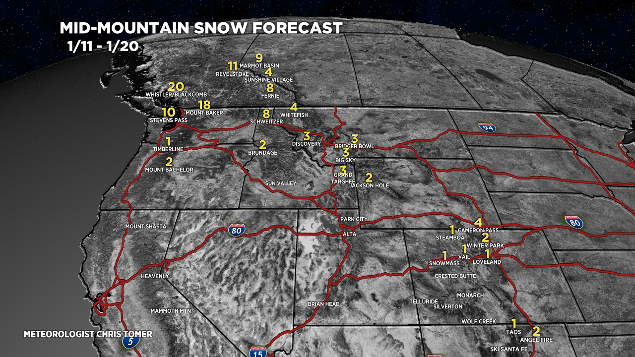
- I’m forecasting zero snowfall in CA and UT through 1/20.
- Large high pressure dome dominates the West and Intermountain West through 1/20 with a couple minor fronts.
- Waiting game: when will the high pressure break? We might have to wait until after 1/21.
Infrared satellite shows the current storm track and atmospheric river flow into the PNW.

Here’s the latest integrated vapor transport (IVT) forecast for the Pacific Northwest (48N, 124.5W), which helps pinpoint the atmospheric river.

Looking down the road
High pressure remains strong across the West until possibly 1/21 or later.

Snow Forecast
The minor snow you see in Colorado occurs on 1/14 with a minor, fast-moving cold front.

For more analysis please watch my forecast video: