Tomer’s Take: Current storm cycle lasts through 2/12 then high pressure builds. Next storm system is hitting CA with a moderate/strong atmospheric river (AR) surge 2/4-2/5. Then this storm system breaks loose 2/5-2/8 and hits UT/ID/WY/MT/CO/NM with heavy snow accumulation. A smaller storm system 2/8-2/9 races into UT/AZ/CO/NM and meshes with the prior storm system and keeps the snow going. Another small storm system 2/10-2/12 takes a northern track and moves through BC/MT/ID/WY/UT/CO with light to moderate snow accumulation.
My afternoon forecast video update:
Current Setup
Major storm system with a moderate/strong AR surge continues in California 2/4-2/5. Then this storm system breaks loose 2/5-2/8 and hits UT/ID/WY/MT/CO/NM.
Central CA Radar 2/4 at 3:45pm:

Water vapor satellite shows the storm system off the CA coast. The other storm system will curve into AK/Canada and eventually send energy south into the United States.
Orange/red = drier air aloft.

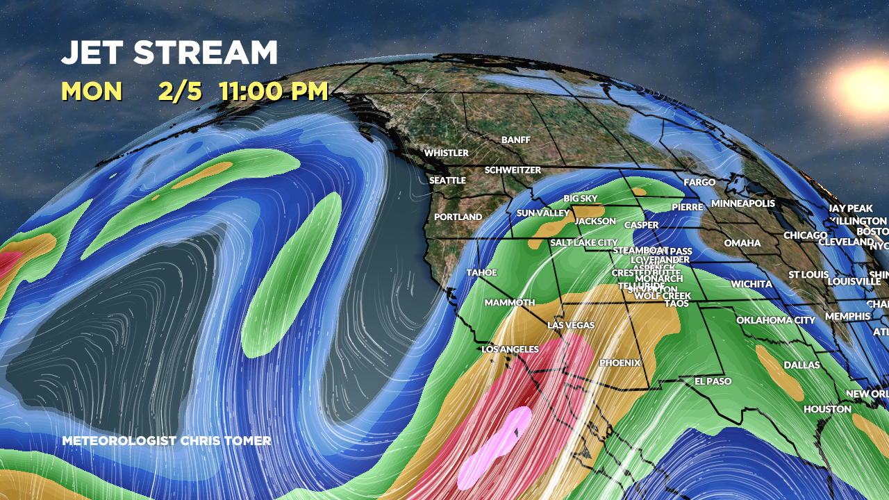
Forecast Jet Stream
Powerful moisture transport into CA and optimized Subtropical jet stream orientation.

Storm system(s) and trough sliding through the Rockies with heavy snow accumulation.

Storm system and remaining trough exiting CO/NM. Small storm system in BC races southeast into Northern Tier.

Forecast Radar & Satellite
Forecast Totals
UT Snow: 2/5-2/9, 2/12.
CO Snow: 2/6-2/10, 2/12.
WY Snow: 2/5-2/8, 2/10-2/11.
Revelstoke Snow: 2/4, 2/6, 2/8-2/9, 2/11.


VT/NH/ME Snow: 2/10, 2/12-2/13.
