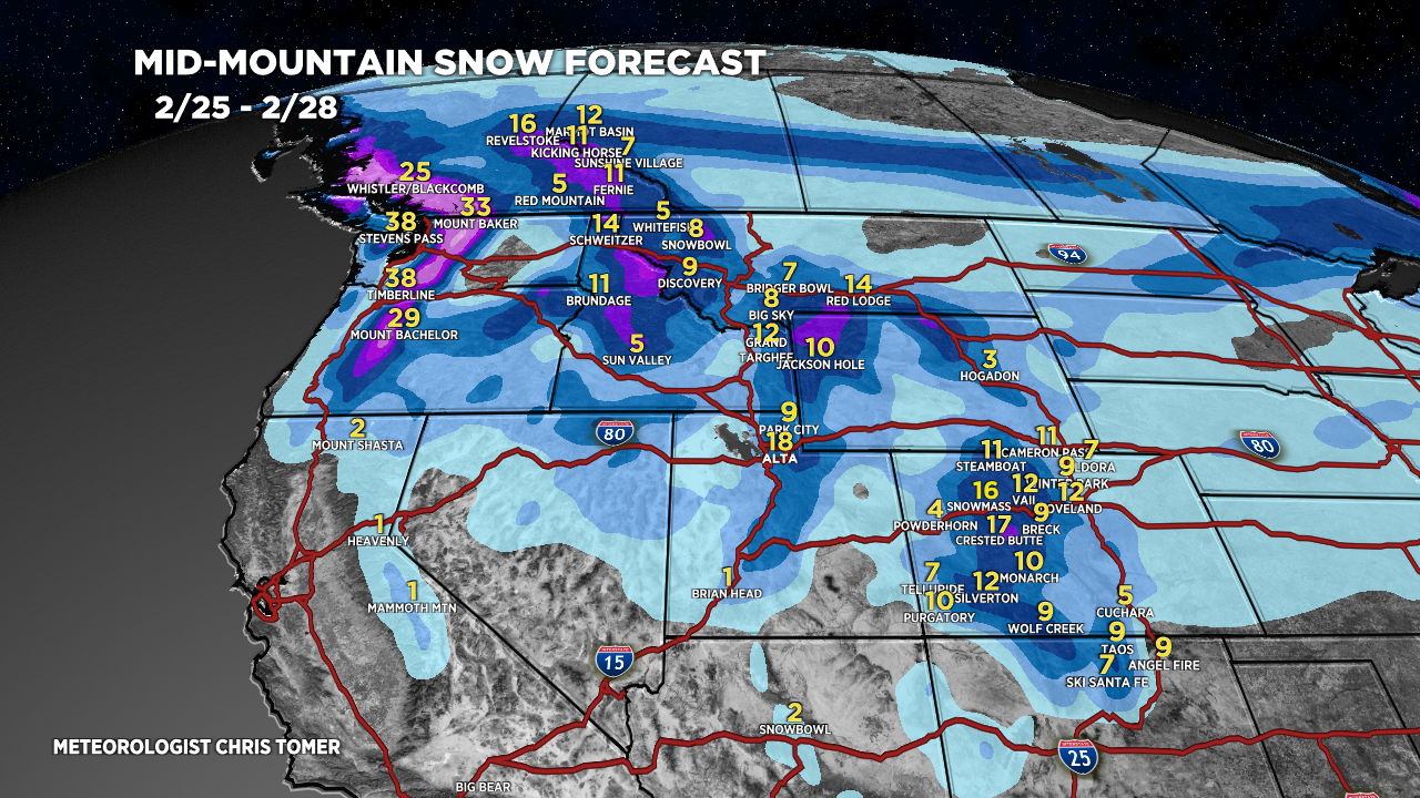
Tomer’s Take: Merging jet streams deliver a major storm system 2/26-2/27 to ID/WY/UT/CO and 50-70mph wind gusts. I trimmed a few snow totals down 20%. I’m calling this storm system the ‘Robust Quick Strike’. Storm #2 is major 2/29-3/5 with heavy snow accumulation. This storm system appears bigger than storm #1.
My afternoon forecast video update:
Forecast Radar & Satellite
Forecast Totals

Storm #2 ->
Bulk of snow:
UT: 3/2-3/3.
WY: PM 2/29-3/3.
CO: 3/3-3/4.

Northeast:
Rain on 2/28 changing to light snow accumulation late 2/28 into early 2/29.

As always, great content! Out of curiosity, are these snow forecasts for the base or summit of these mountains… for example Jackson Hole?
Hi Chad! These are all mid-mountain snow forecasts.
Chris