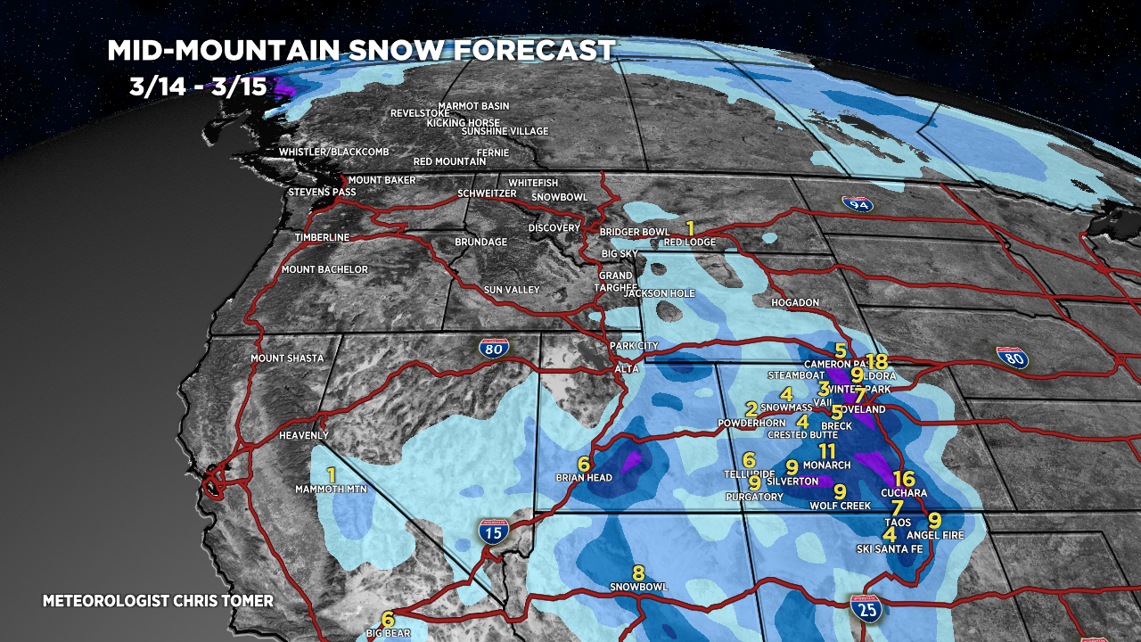
Tomer’s Take: Another 1-2 feet of snow accumulation in the Foothills of Colorado by early 3/15 then snow tapers off. It’s a backbreaker snow accumulation with marginal temps for many locations including Denver.
This storm system gets cut-off from the main flow 3/15-3/20 and retrogrades west into AZ/UT. The pattern dries out in the Central/Northern Intermountain West until on/after 3/21.
Timing
*Updated 5pm 3/14/2024.
CO Snow Tapers Early 3/15.
Low Retrogrades into AZ/UT/NM/SW CO for several days.
Tetons: Next Storm System 3/21-3/24.
Wasatch: Next Storm System 3/21-3/24.
Colorado: Next Storm System 3/21-3/24.
Northeast: Rain 3/15, R 3/17, Light Accum 3/18, H 3/23.
My afternoon forecast update video:
Current Setup
Water vapor satellite shows the dance going on between the building high and the big Colorado snowstorm.
Red/orange = drier air aloft.

Forecast Radar & Satellite
Forecast Totals


Northeast:
VT/NH/ME: Rain 3/15, 3/17, Light Snow Accum 3/18, Heavy 3/23.

18” here at our home in Castle Rock Thursday morning. Looks like we will get every bit of 2’ before its done
Thanks, Randy! That’s a big dump. Chris