Tomer’s Take: It’s a powder Monday in UT/WY/CO/NM! This storm system is pivoting through Southern Colorado and New Mexico next 12-24 hours then away. There are three additional storm systems lined-up through 4/3.
Timing
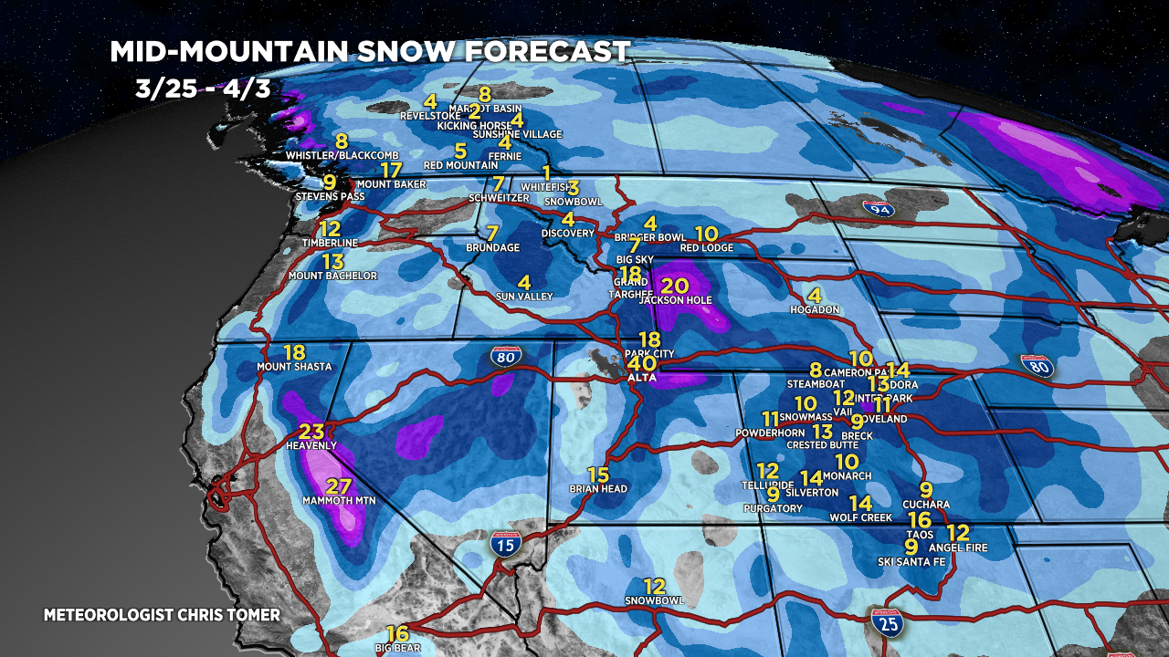
*Updated 4pm 3/25/2024.
Storm System pivots out of CO/NM.
Three Storm Systems Remaining through 4/3.
Sierra: H PM 3/27-3/30.
Tetons: L Tonight, L/M 3/26, H Late 3/27-3/28, H 3/29-3/31.
Wasatch: L Tonight, M 3/26, H 3/28-3/30, H PM 3/31-4/1.
Colorado: L/M PM 3/26, L/M PM 3/28-3/29, H 3/31-4/1.
Northeast: L 3/27, H 4/2.
My afternoon forecast video update:
Current Setup
Water vapor satellite shows the CO/NM storm pivoting away. The Pacific is loaded with three additional storm systems.
Orange/red = drier air aloft.

Forecast Radar & Satellite
Forecast Totals
Grand totals by late 4/3.


