Tomer’s Take: Powder weekend ahead, but use extreme caution! Feet of additional accumulation likely in UT/CO/OR. An Arctic front and storm system are inbound 1/12-1/15. Snow increases afternoon 1/12 in UT/CO along with 40-70mph wind gusts raking the high peaks of WY/CO/UT. Strong wind continues into 1/13. Snow decreases in WY afternoon 1/12 as the Arctic front slides south and drapes itself over OR/UT/CO. The main area of low pressure rotates through OR and then CA 1/12-1/13. It breaks loose and moves east into UT/WY/CO late 1/13-1/15 with another round of heavy snow. A second storm system races out of the PNW into ID/MT/WY/UT/CO on 1/17-1/18 with additional accumulation.
In the Northeast, a powerful storm system hits late 1/12-1/13 with 70mph wind gusts and heavy snow changing to rain/snow VT/NH/ME. Another storm system is possible 1/19-1/20.
My afternoon forecast video:
Wind Gust Forecast
Brutal conditions in Colorado. Observations from Berthoud Pass this morning:

Max Gust Forecast.
Central & Northern Mountains, CO:
1/12: 75mph.
1/13: 50-80mph.
1/14: 50-55mph.
Teton Range, WY:
1/12: 75mph.
1/13: 50mph.
Wasatch Range, UT:
1/12: 70mph.
1/13: 40mph.
1/14: 55mph.
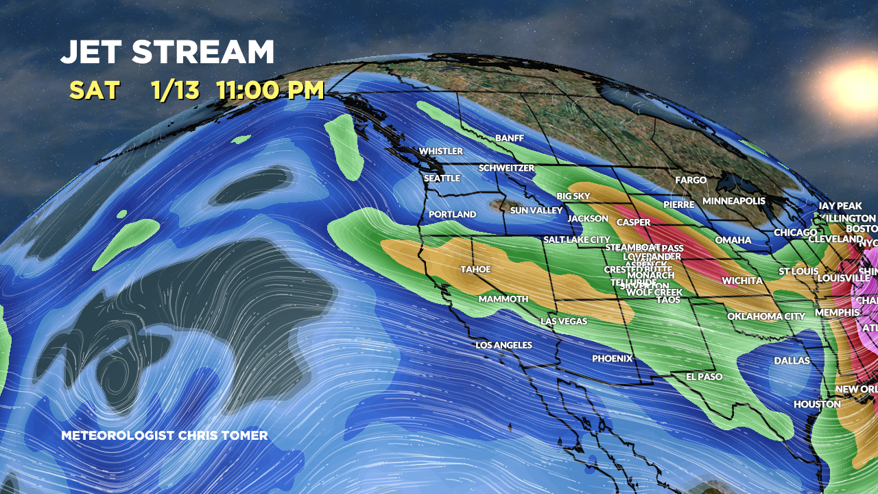
Forecast Jet Stream
Arctic front + storm system and powerful northern & southern jet support.

Second storm system 1/17-1/18 with fast WNW flow across ID/WY/MT/UT/CO.

Forecast Radar & Satellite
Forecast Totals
Grand totals by late 1/21.
UT Snow: PM 1/12-1/15, 1/17-1/18.
CO Snow: PM 1/12-1/15, 1/17-1/18.
WY Snow: 1/14, 1/17-1/18.

Arctic front + storm system.

Storm system + WNW Flow 1/17-1/18.

Northeast:
VT/NH/ME Snow: 1/13, 1/14 (light), 1/16 (light), 1/19-1/20.
