Tomer’s Take: The stormtrack now favors the PNW/BC/ID/MT/WY through 2/15. Then it shifts south 2/16-2/21 to favor CA/UT/ID/WY/CO. The initial storm system is trending weaker/faster, but additional waves of moisture get pushed through the interior Rockies by a strong Subtropical jet.
The Northeast gets moderate to heavy snow 2/13 and 2/16. 2/13 stormtrack is trending a little further south.
My afternoon forecast update video:
Current Setup
Water vapor satellite shows a trio of storm systems over the North Pacific. The first two affect the PNW/BC/Northern Tier, and the third is part of the pattern shift after 2/15.
Orange/red = drier air aloft.

Forecast Jet Stream
Forecast Radar & Satellite
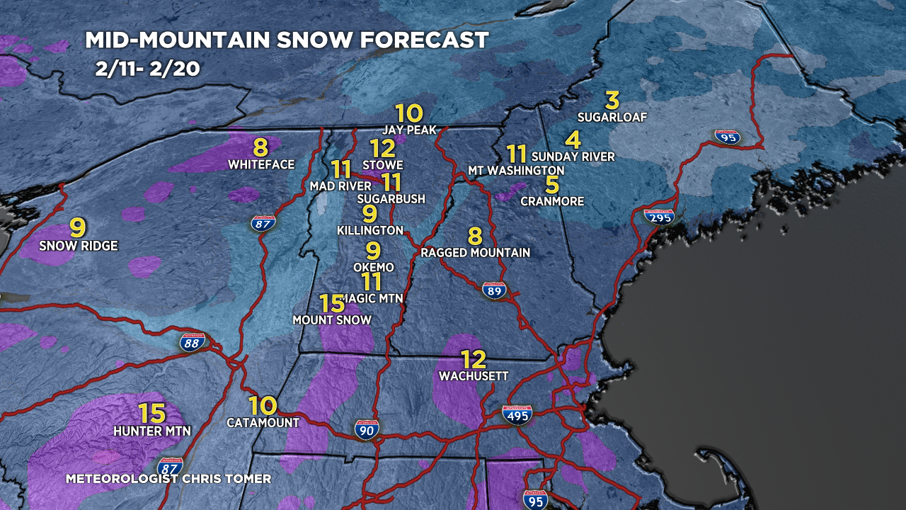
Forecast Totals

Teton snow: 2/13-2/15, 2/18, 2/20.
UT snow: 2/15-2/16, 2/18, 2/20-2/21.
CO snow: PM 2/15-2/16, 2/18, 2/21.


Northeast:
2/13 storm system mainly delivers snow to southern VT, southern NH, southern NY, southern ME, MA.
Late 2/15-2/16 delivers snow to most of VT/NH/ME.

Thank you very much for your outstanding coverage. It really helps in planning travel through the mountain regions.
Thanks, Ivan! Chris