Tomer’s Take
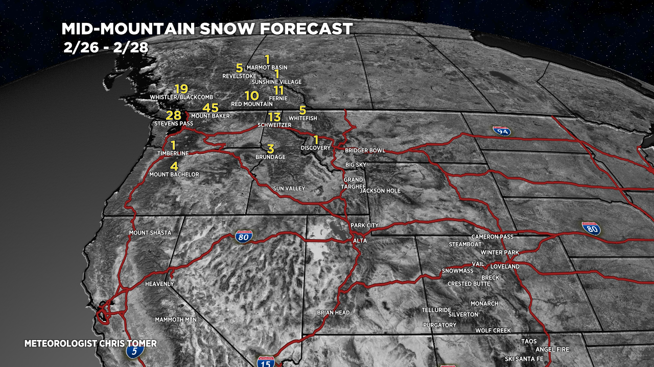
- Storm track shifts north 2/26-3/2 favoring the Pacific Northwest (PNW), British Columbia (B.C.), northern ID, and northwest MT.
- Then it gradually shifts south on/after 3/3 to hit the Intermountain West.
- Said another way, expect a quiet period across the Intermountain West until 3/3 or later.
I was out backcountry skiing this morning in the Central Mountains of Colorado on the Divide. Air temps were running -10 to -15F. Wind was generally under 20mph. Snow was slow.

Here’s my latest mountain weather forecast video:
2/26-2/28. My snow forecast beyond 2/28 is included in the above video.

Glad you’re getting out and enjoying the snow, Chris!
Thanks, Rob! Chris