Tomer’s Take
- The jet stream currently favors the Pacific Northwest (PNW), British Columbia, northern Idaho, and northwest Montana through 3/3. This is technically a weak atmospheric river setup. Mount Rainier could see 3-4 feet of snow at/above Muir with 70mph gusts.
- Snow levels are running high. Up to 8,000ft in some cases. Snow levels will gradually lower Tuesday, Wednesday, and Thursday.
- Then the storm track gradually shifts south after 3/3 and hits the Intermountain West.
- A dipping jet stream and lower pressure anomalies continue to hit the Intermountain West on/after 3/3 through 3/10. This could translate into colder and snowier conditions.
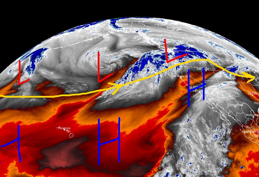
Water vapor satellite shows the storm track favoring the PNW/B.C./Northern Tier. Orange/red = drier air aloft.

March 3-10
A large trough of low pressure appears to dominate the West/Intermountain West 3/3-3/10. Below, notice the forecast pressure anomalies valid 3/8/2022.

Will this stormy pattern last beyond 3/10? Some data suggest it lasts through 3/12.
Snow Forecast
2/28-3/3:

3/4-3/9:

Northeast, 2/28-3/9:

For more analysis please watch my forecast video: