Tomer’s Take
- 2-3 more storm systems lined-up for the West.
- Largest storm system and possible merger on New Year’s Eve/Day.
- Cold blast following this final storm system.
The latest infrared satellite reveals the storm track with storm systems lined-up.

Let’s look at the final storm systems of this cycle. There are two moving pieces.
- Pacific Northwest low pressure & cold front
- Desert Southwest low pressure
> If the two merge over the 4-Corners then a much larger storm system emerges between New Year’s Eve and New Year’s Day for UT, NM, CO, ID, MT, and WY.
>If the two don’t merge than two smaller waves of snow move through UT, NM, CO, ID, MT, and WY.
Here’s the forecast jet stream setup on 12/31/2021:

This setup delivers a surge of strong wind to the Intermountain West on 12/30-12/31. My forecast wind gusts on select Colorado 14ers:

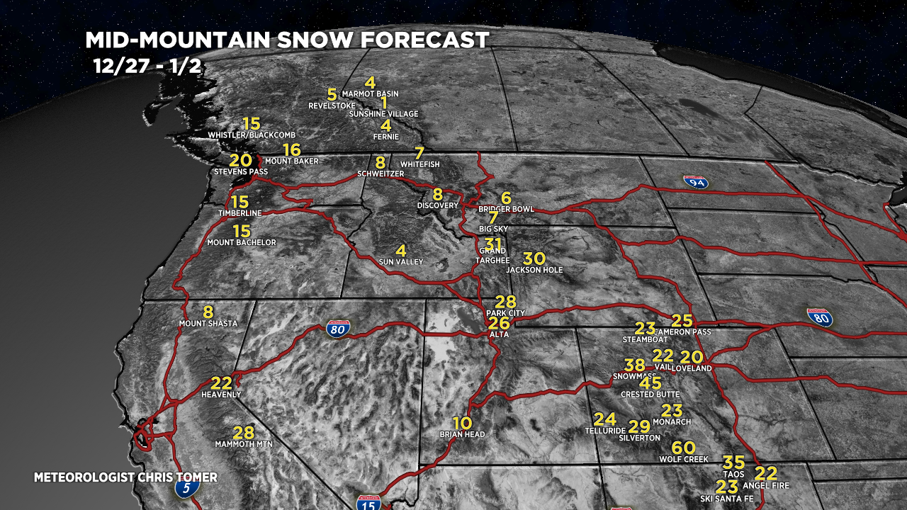
Snow Forecast
Forecast totals 12/27-1/2:

Drilling down, here’s my snow plume forecast for Crested Butte, CO:

- If this verifies, then Crested Butte storm cycle grand totals from 12/23-1/2 will hover around 85″.
One more, Jackson Hole, WY:

For more analysis please watch my forecast video:
Great stuff, Chris! It must be fun to the bearer of such good news.
Thanks, Rob! It’s a bright spot right now for sure. Chris