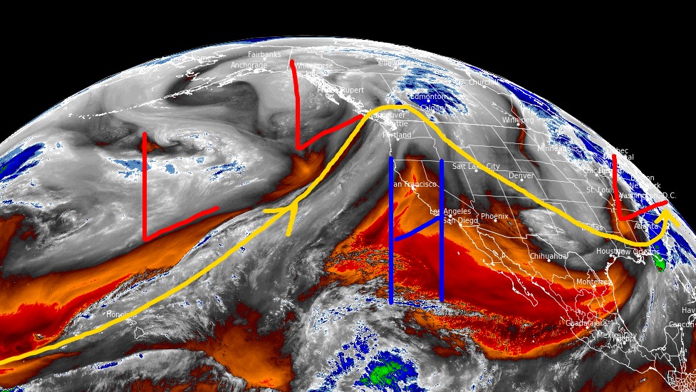
Tomer’s Take
- High pressure builds with Spring skiing through this weekend. Warmer temps at most ski areas.
- The storm track shifts into the Pacific Northwest, British Columbia, northern ID, northwest MT through 3/28.
- On 3/28 a storm system hits CA then moves east into ID, MT, WY, UT, CO, and NM through 4/1.
Water vapor satellite shows the storm track, Western high pressure, and storm track shifting into the PNW/B.C.

Late March
A stormier weather pattern returns to the West late March and early April. Below, notice the forecast pressure anomalies valid 3/29.

Snow Forecast
3/23-3/28:

3/29-4/1:

Northeast, 3/23-4/1:

For more analysis please watch my forecast video: