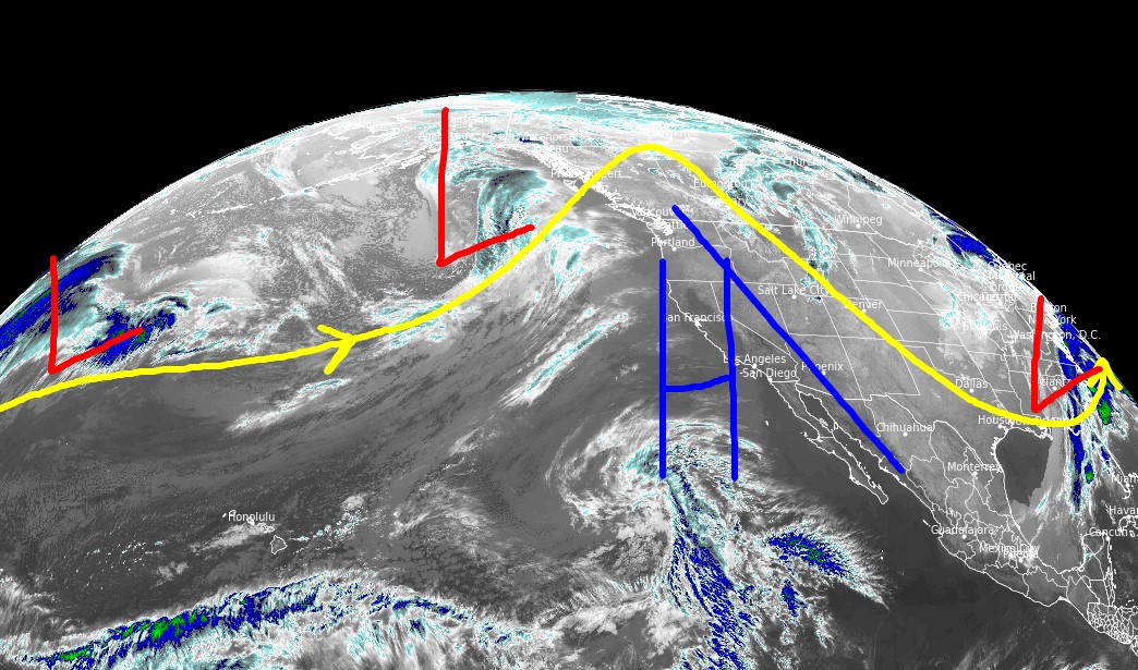
Tomer’s Take
- Big high pressure builds across the West through 3/28. Abnormally warm temperatures likely. Spring skiing is in full swing.
- Then a storm system hits CA on 3/28 and moves east into ID, MT, WY, UT, CO, NM 3/29-4/2.
- This storm system will run into warmer temps and some of the precipitation will start as rain or a rain/snow mix in many mountain valleys.
Infrared satellite shows the storm track and high pressure building in across the West.

3/28-4/2
High pressure breaks down after 3/28 as a storm system moves into the West. Below, notice the forecast pressure anomalies on 3/29.

Snow Forecast
3/24-3/28:

3/29-4/2:

Northeast, 3/24-4/2:

For more analysis please watch my forecast video: