Tomer’s Take
- Storm track continues to favor Pacific Northwest, British Columbia, northern Idaho, and northwest Montana through 3/3.
- Snow levels are running high at times. Yesterday the rain/snow line was around 8,000ft. Today is drops about 1,000 feet and then drops another 1,000 feet on Wednesday.
- The storm track shifts south after 3/3 and hits southern ID, southern MT, CA, UT, CO, WY, NM.
- Snow and colder temps are likely 3/4 through 3/12. This storm cycle is not as cold as last week.
Infrared satellite shows the storm track. This is technically a weak atmospheric river setup for the PNW/B.C./northern ID/northwest MT.

Pattern through 3/12
The pattern remains active across the West through 3/12 then it’s unclear what occurs. Below, notice the forecast pressure anomalies valid 3/9.

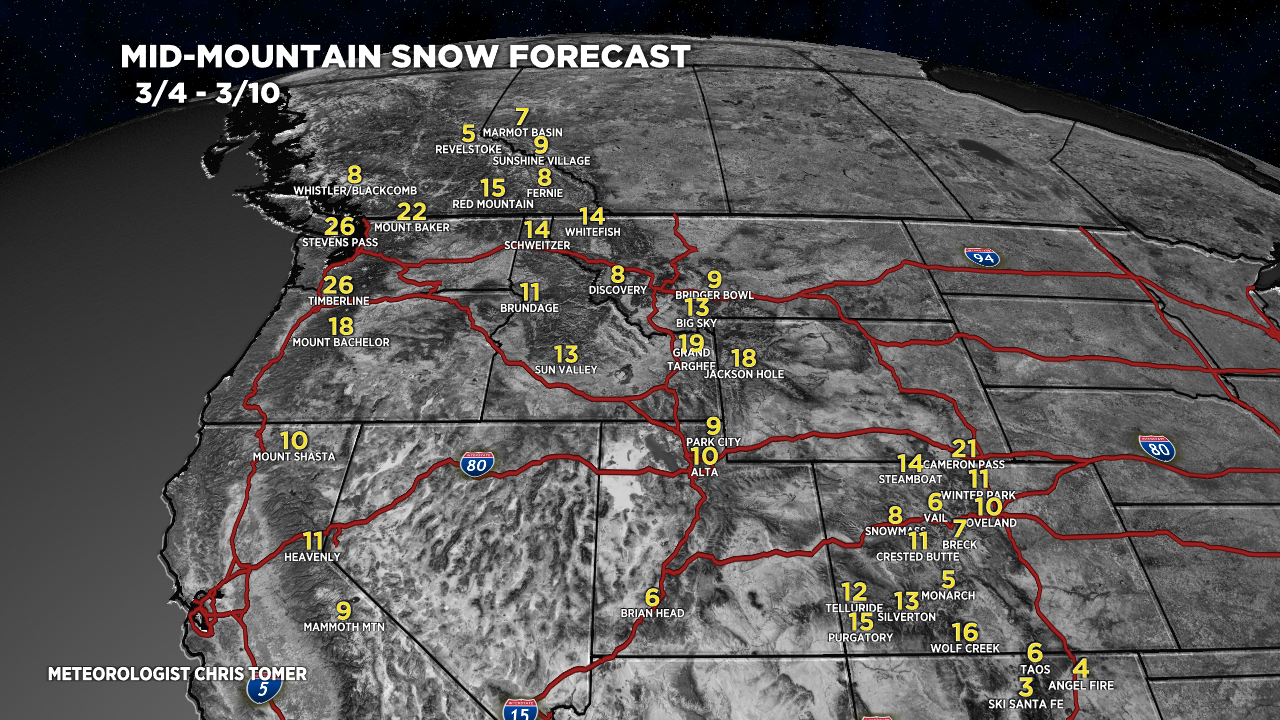
Snow Forecast
3/1-3/3:

3/4-3/10:

Northeast, 3/1-3/10:
