Tomer’s Take: Two shots of accumulating snow hit WY on 12/10 and 12/11. 30-60mph wind gusts hit Colorado’s Continental Divide on 12/10. Shifting flow pattern favors ID, WY, MT, PNW, BC through 12/18. Unfortunately, UT and CA look mostly dry through 12/18.
My forecast video:
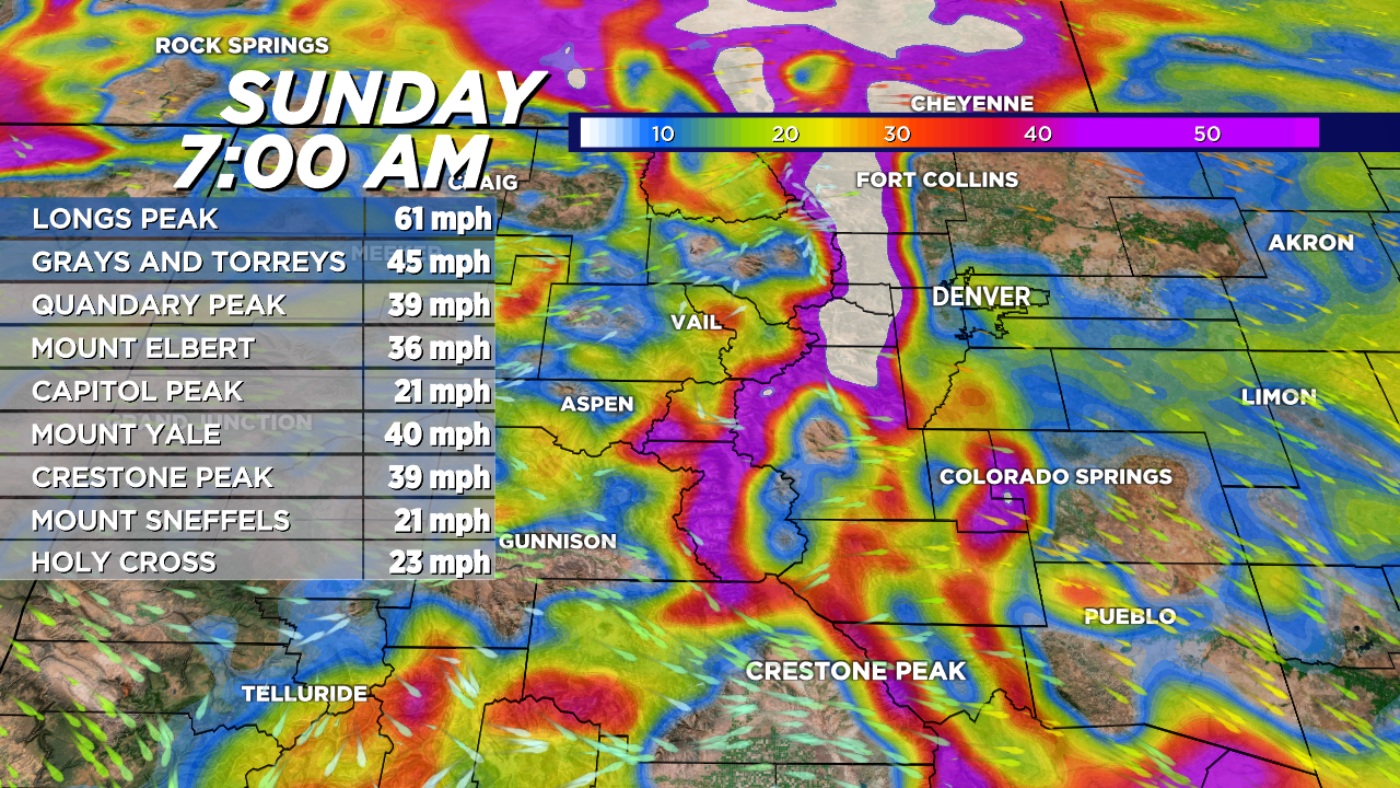
Windy CO Continental Divide 12/10
Valid 7am 12/10. Expect 30-60mph gusts on the Front Range high peaks, Indian Peaks, Longs Peak, and Cameron Pass.

Forecast Totals

Windy East Coast Storm System
Valid late 12/10. Powerful jet but bad track for heavy snow in VT/NH/ME with rain initially then changing over to snow late 12/10 into 12/11.

Valid late 12/10. Forecast radar shows rain initially then changing over to snow.


Thx for the east coast glance, is very helpful for traveling this week!
You bet, thanks, Doug! Safe travels.
Chris