Tomer’s Take: The current storm cycle ends with one final cold front that hits Colorado with the coldest air of the season and 8-24″ of snow accumulation. Strong jet dynamics and temperature efficiency will help generate the snow.
Colorado mountain temps dip below zero late 10/29 into 10/30.
Wyoming mountain temps dip below zero 10/28, 10/29, and 10/30.
Montana mountain temps dip below zero 10/27, 10/28, and 10/29.
Current Setup
Water vapor satellite shows the final cold front diving south through ID, MT, WY with light snow accumulation and a reinforcing shot of cold air. This front hits Colorado 10/28-10/29. It slows down and amplifies over the mountains.

Forecast Radar 10/28
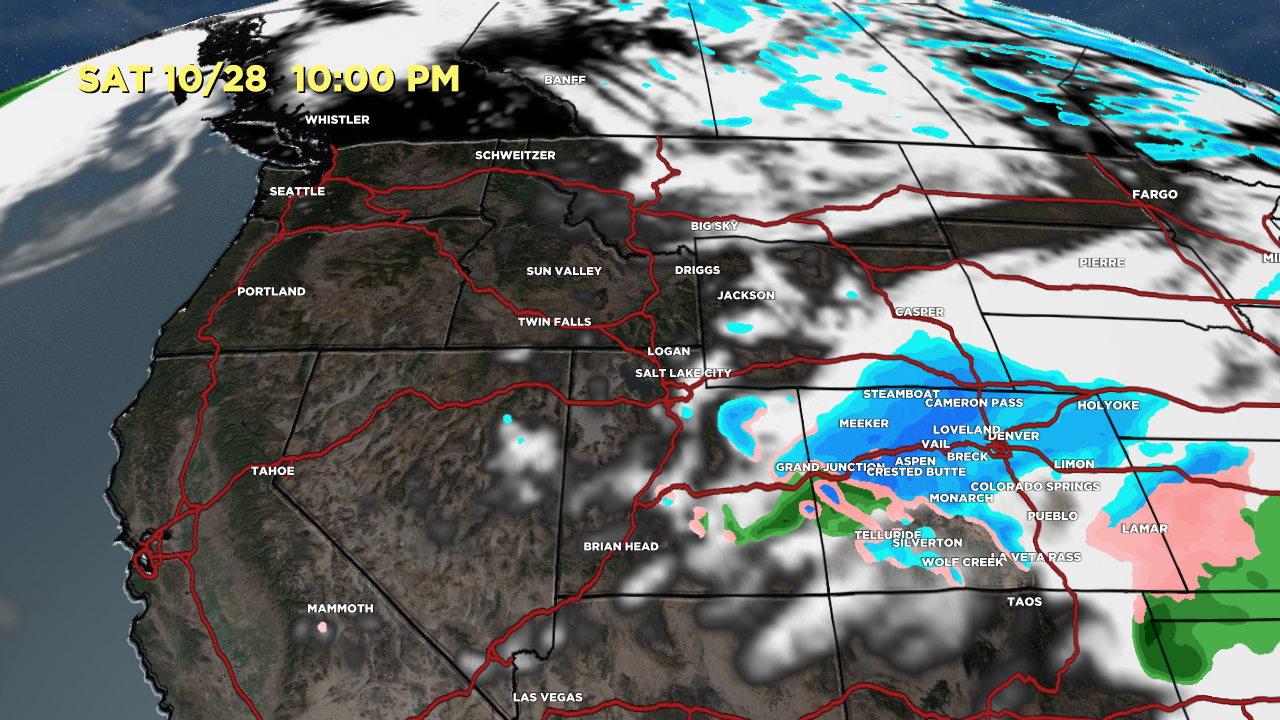
Valid 10/28 10pm. Snow levels fall rapidly Saturday afternoon/night as colder air pours in. It’s all snow in Denver at 5280′.

Full Forecast Animation:
Forecast Jet Stream
Valid 10/28 11pm. Notice the trough over the Intermountain West supporting the final cold front and efficient upslope flow in Colorado’s mountains.

Forecast Snow
Mid-mountain valid 10/27-10/29.

Mid-Mountain Snow Forecast Timeline ->
Snowmass:
10/28: 10″+
10/29: AM 1-3″
Quandary Peak:
10/28: 8-12″
10/29: 2-6″
Gore Range:
10/28: 8-12″
10/29: 2-6″
Vail Mountain:
10/28: 8-12″
10/29: 2-6″
Woo Hoo! Thanks Chris!
Thanks, Holly!
As always we will be looking to your forecast for our skiing here in Colorado !
Thanks for the update Chris!!! Looking forward to your snow forecasts this Winter.
Thanks, Tim!
Thanks, Bradley!
Let the games begin!!!
Yes! Thanks, Brett.
Greetings from the mid-west. Looks like CB beat the over with 25 inches. Pretty amazing you put the snow-point-spread at 8″-24″ and it delivered. amazing you were within one INCH!
This is why you earned the moniker, MVM = the most valuable meteorologist. Undefeated and Undisputed.
Thanks, Randall!