Tomer’s Take
- Additional big powder days ahead through 1/1/2022 for West.
- Major trough of low pressure remains in position over the eastern Pacific located just off the West Coast.
- Jet stream remains in prime position for the West through 1/1/2022.
- Big wind 50-100mph hits the snowpack of UT, WY, and CO on 12/26.
- Storm cycle might end as a NW flow type pattern on 1/1/2022 for UT, WY, MT, CO.
- 41″ in 48 hours at Crested Butte, CO. 2-3 more storm systems to go. Temps will drop 10-15 degrees going forward in Colorado.
- 33″ in 48 hours at Wolf Creek, CO. Same ingredients as Crested Butte with additional storm systems and colder air.
You can see the major dip in the jet stream and trough of low pressure on this infrared satellite image.

A 200mph jet streak delivers the next storm system in this cycle to CA, ID, UT, CO, WY 12/25-12/26:

Big wind coming to Utah, Colorado, Wyoming 12/26. Here’s my forecast for select 14ers in Colorado:

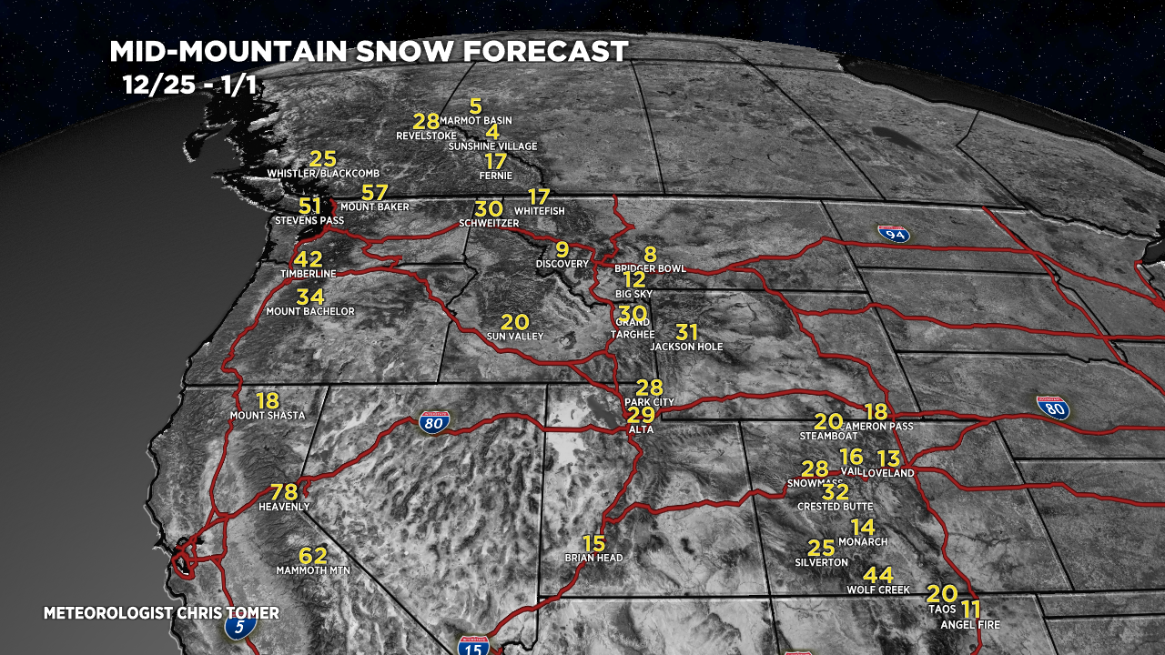
How much additional snow through 1/1/2022?

For more analysis please watch my forecast video:
Love these updates!
Looking to drive from Denver to Wolf Creek to ski some time soon, need to be back before 1/7. Any idea on when there might be a break in all the snow for safe road travel?
Hi Tiffany, you could go this afternoon but count on closures for avalanche mitigation. Next break occurs midday Monday, but again plan on avalanche mitigation. Next break is Thursday. Chris