Tomer’s Take: It’s a waiting game out West where the mountains continue to get blasted with abnormally warm Pacific air. Precipitation hits CA 12/18-12/20, but the rain/snow line starts at 9,000-10,000ft. I’m only forecasting light snow accumulation for the Wasatch, Tetons, MT, and ID on/after 12/20. The exception will be CO, NM, and Southern UT where a stronger area of low pressure might develop 12/24-12/25.
My forecast video:
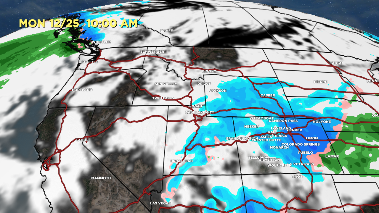
Christmas Day Forecast
Potential stronger area of low pressure develops in Southern CO and Northern NM. This is a long shot.
Valid 10am 12/25, Forecast Radar & Satellite:

Forecast Radar & Satellite
Forecast Totals
Sierra rain/snow line starts at 9,000-10,000ft 12/17-12/19 then gradually falls to 8,000ft.


This assumes best/worst case scenario with stronger low development in Southern CO/Northern NM 12/24-12/25.


So sad an inch in Steamboat! I hope something gives soon!
Any hopes for snow in January or February in Bg Sky? Yikes we are low.
Hi Barbara –
January does look more active with snow for the Intermountain West. Chris
Other than the Boat, Aspen and Fail….CO has been pretty low tide so far.
Hoping for a fast start to New Year. Time to travel to Idaho!
Hi CW – No doubt…end of year and January looking more active with snow and more productive storm track! Chris