Tomer’s Take: This is a challenging period with mostly dry conditions across the Intermountain West and rain (again) in the Northeast. The main storm track impacts BC/WA/OR/CA, but very little of this moisture survives the trip into the Interior Rockies.
My forecast video:
Current Setup
Water vapor satellite shows an active Pacific storm track aiming at BC/West Coast. But, very little of this moisture survives the trip into the Interior Rockies.
Orange/red = drier air aloft.

Forecast Jet Stream
Trough of low pressure approaches the West Coast.

Cold air remains trapped in Canada with northern branch. Active subtropical jet delivers a storm system to the Intermountain Weather 1/3-1/5.

Forecast Radar & Satellite
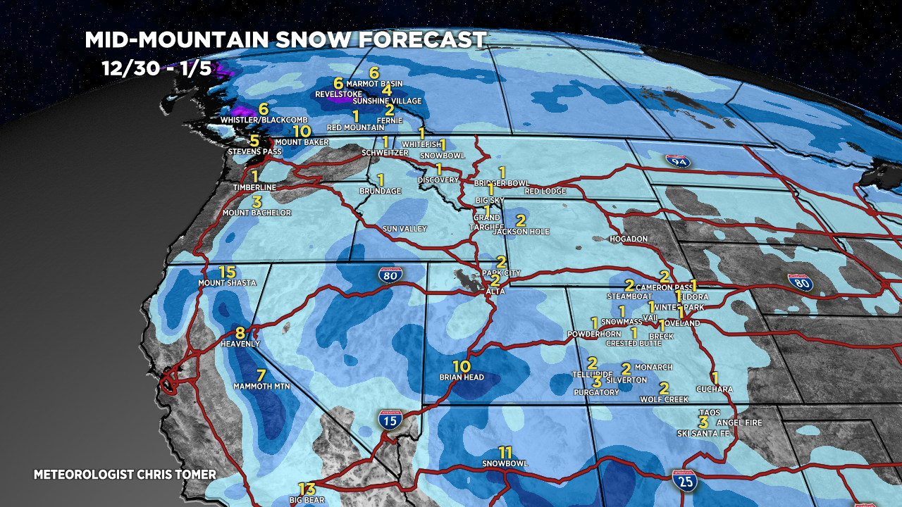
Forecast Totals
PNW/BC rain/snow lines fluctuates 4500′-5500′.

UT Snow: 1/3-1/4.
WY Snow: 1/4.
MT Snow: 1/4.
CO Snow: 1/4.

VT/NH/ME Rain 12/27-12/29, changing to snow 12/30.
