Tomer’s Take: Two storm systems are lined-up through 11/10. One additional moderate intensity atmospheric river (AR) surge occurs 11/5 in the PNW/BC then it concludes. Utah and Colorado get light to moderate snow accumulation 11/7-11/8.
My forecast video:
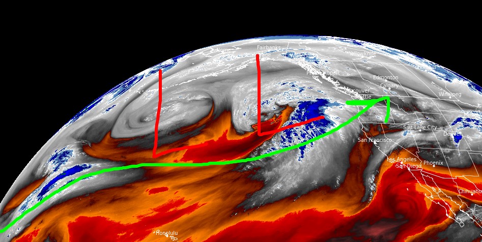
Current Setup
Water vapor satellite shows both storm systems over the Pacific and AR flow.
Orange/red = drier air aloft.

Forecast Jet Stream
Valid 11/11. The AR is done.

Forecast Radar & Satellite
Forecast Snowfall
*Updated 2:30pm 11/3

*Updated 2:30pm 11/3
Snow in UT & CO occurs 11/7-11/8.

Forecast Snowfall Timeline ->
Teton Range, WY:
11/3: AM 2″
11/4: Late 1″
11/5: AM 3″
11/6: PM 3″
11/7: 2″