Tomer’s Take
- Final storm system of this cycle. Then high pressure builds.
- Drier, warmer period 1/9-1/14 for the Intermountain West.
- Pattern might change after 1/14.
Notice the storm track and lurking high pressure dome on the water vapor satellite image.

High Pressure
A ridge of high pressure builds 1/9-1/14 across the Intermountain West.

When does it break? Maybe after 1/14. This is 1/17-1/18 –>

Forecast Snow
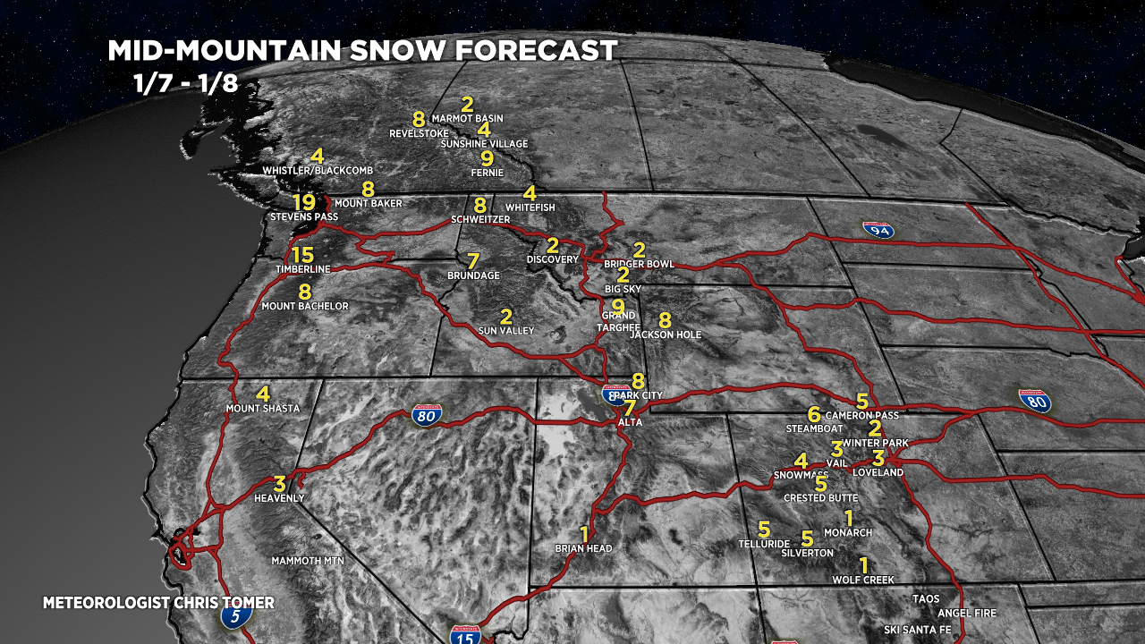
Let’s look at my snow forecast in three time periods.
1/7-1/8:

1/9-1/13:

1/14-1/16:

For more analysis please watch my forecast video:
Thank you for these updates, Chris, you work is much appreciated!
Thanks, Doug! Hope you’re well. Chris