Tomer’s Take
- Storm #1 is sliding through MT, WY, ID, UT, CO, NM on 2/16 ending early 2/17.
- A dry 2-3 day break follows this storm system.
- Storm #2 arrives 2/20-2/23 (possibly lingering into early 2/24).
- Will it be followed by high pressure or another storm system into March1? Data is split and confidence is low.
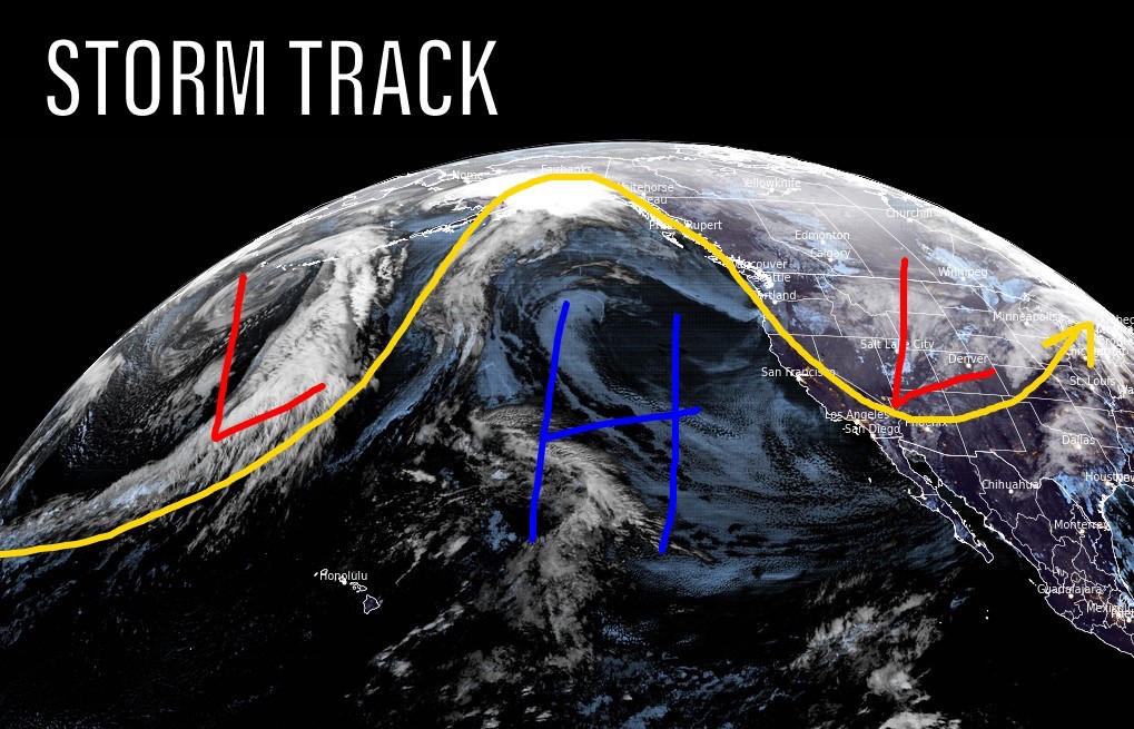
Infrared satellite shows the storm track and both storm systems separated by high pressure.

Storm #2
Storm #2 appears stronger and colder than storm #1. It’s the beneficiary of storm #1 dislodging a long-standing high pressure dome.
Snow forecasts are all over the board and confidence remains low where the bullseye(s) will end up. But, notice the significant forecast pressure anomalies valid 2/21-2/22.

Beyond Storm #2
What happens 2/24-3/1? Data is split and confidence is low. Here’s one possibility with high pressure rebuilding.

Snow Forecast
2/16-2/19:

2/20-2/25:

Steamboat snow plume forecast:

Northeast, 2/16-2/25:

For more analysis please watch my forecast video:
Chris,
I enjoy your blog. Could you add Purgatory to the map?
Thanks, JG…done! Chris
Just joined the blog! When do you think snow will fall in Denver and the foothills on Monday?
Hi James, temps will be so cold Tuesday-Wednesday that it’ll be a drier, pixie dust snow. Foothills 5-10″. Denver Metro 2-5″.
It’ll be on/off for a few days starting Monday night.