Tomer’s Take
- Minor, fast-moving cold front on 2/11 races south through MT, WY, CO, and NM. Light snow accumulation.
- Alberta Clipper hits the Northeast late 2/11 through 2/12. Light snow accumulation plus some lake-effect.
- Dry all weekend in the Pacific Northwest and British Columbia.
- Larger storm system pierces the large Western high pressure ridge early next week, 2/15-2/17. This storm system delivers a shot of colder air as well. Strong wind above treeline.
- Western high pressure rebuilds 2/18-2/21.
Infrared satellite and storm track shows the large Western high pressure ridge.

Long Range
High pressure rebuilds 2/18-2/21. Then it looks stormy again 2/22-2/24 with a trough of lower pressure sliding into the West breaking down the high pressure ridge.
Below, notices the forecast lower pressure anomalies across the West on 2/22-2/23.

Requests
I’ve had a few requests, here’s an update.
Steamboat: 1-4″ 2/11. 2-6″ 2/16-2/17. High pressure 2/18-2/21. Snow 2/22-2/24.
Revelstoke BC: 3-6″ snow 2/15-2/18. 3-6″ 2/19-2/20.
Red Mountain BC: 1-3″ 2/14. 2-4″ 1/19-1/20.
Dallas Peak, CO: 1″ 2/11. 6-8″ 2/16-2/17. High pressure 2/18-2/21. Snow 2/22-2/24.
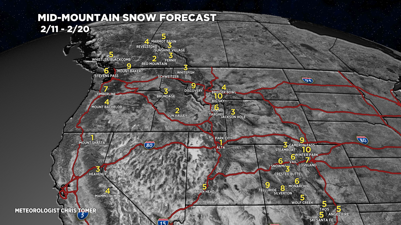
Snow Forecast
2/11-2/13:

2/14-2/20:

Northeast, 2/11-2/20:

For more analysis please watch my forecast video:
Appreciate all you do with our weather forecasting, thank you!
Thanks, Mark! Chris