Tomer’s Take
- A minor, fast cold front delivers a few snow showers on Tuesday in parts of WY, CO, and NM. Light accumulation.
- High pressure rebuilds through 3/28.
- The exception is the Pacific Northwest, British Columbia, northern ID, and northwest MT where the storm track continues.
- A storm system hits CA on 3/29 then moves east into ID, UT, MT, WY, CO, NM through 4/1.
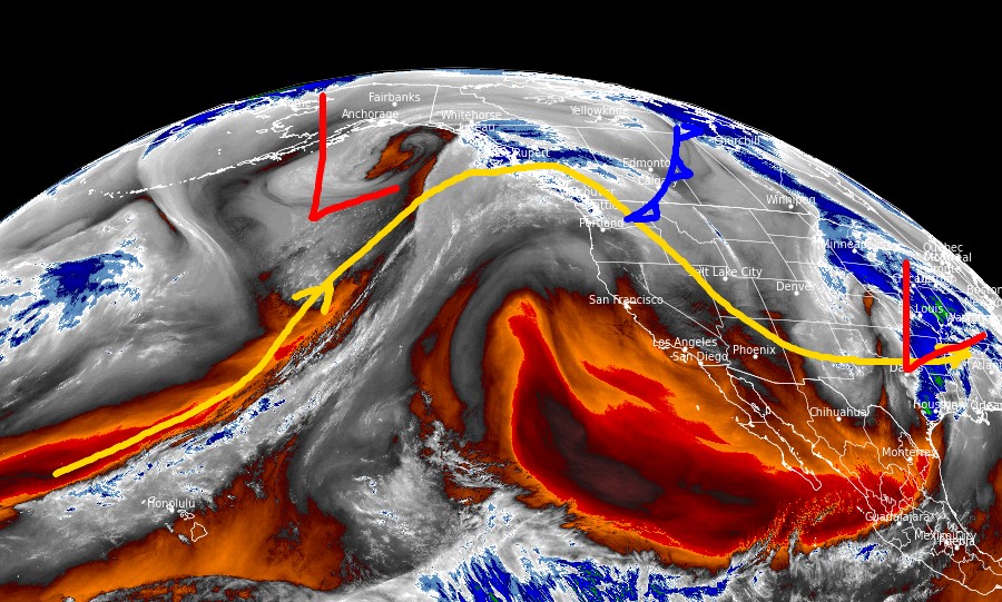
Water vapor satellite shows the storm track and small cold front lined-up for WY, CO, NM. A big ridge of high pressure builds over CA.

Late March
Below, notice the forecast pressure anomalies valid 3/29 including lower pressures across the West.

Snow Forecast
3/22-3/23:

3/24-3/29:

3/30-3/31:

Northeast, 3/22-3/31:

For more analysis please watch my forecast video: