Tomer’s Take
- Storm track favors PNW, B.C. for big totals through 3/24 with a few different storm systems lined-up.
- Storm track sends southern wave of snow into CA, UT, ID, WY, CO, NM 3/15 through 3/17. This is a warmer storm system so snow levels could be a touch higher.
- Another storm system hits same areas 3/19-3/21.
It’s a powder Monday after the sleeper snow. 7″ new at Aspen Mountain.

11″ in 24 hours reported at Alta, UT.
6″ in 24 hours report at Jackson Hole, WY.
Water vapor satellite shows the storm track aimed at the Pacific Northwest. Orange/red = drier air aloft.

3/19-3/21
A cut-off area of low pressure is possible across the West. If this occurs then expect snow for the mountains. Below, notice the forecast low pressure anomalies valid 3/21/2022.

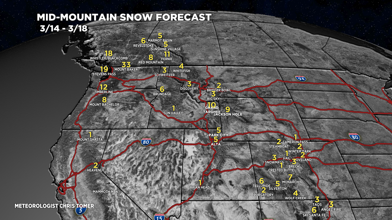
Snow Forecast
3/14-3/18:

3/19-3/23:

Northeast, 3/14-3/23:

For more analysis please watch my forecast video:
Thanks, Chris. Question for you….with the low showing to be south of the Four Corners on Monday 3/21, how is Jackson Hole getting enough moisture to have about the highest snowfall total?
Hi Jim, the storm system drops south through ID, WY, UT on it’s way into CO/NM. That’s where the accumulation comes from. Chris
Jim they are cloud seeding in WY so maybe Chris accounts for this in his predictions. His is the MVM ya know! (Most valuable meteorologist)
Thanks, Randall!