Tomer’s Take
- Heavy snow continues in the Northeast on 2/25. About a foot of accumulation in VT, NH, ME, MA.
- Small wave of snow races through parts of UT, WY, CO on 2/25 with 1-3 inches of accumulation. Then high pressure rebuilds through 3/1.
- Storm track shifts north into the PNW, B.C., and eventually ID, MT through 3/2.
- Then it gradually shifts south to include CA, UT, WY, and CO between 3/3-3/12 with lower pressures in control. This could mean a return to snow and cold for the West.
Wolf Creek
4-Day Grand Total: 51″ (4.1″ SWE)
Ratio: 12.4:1
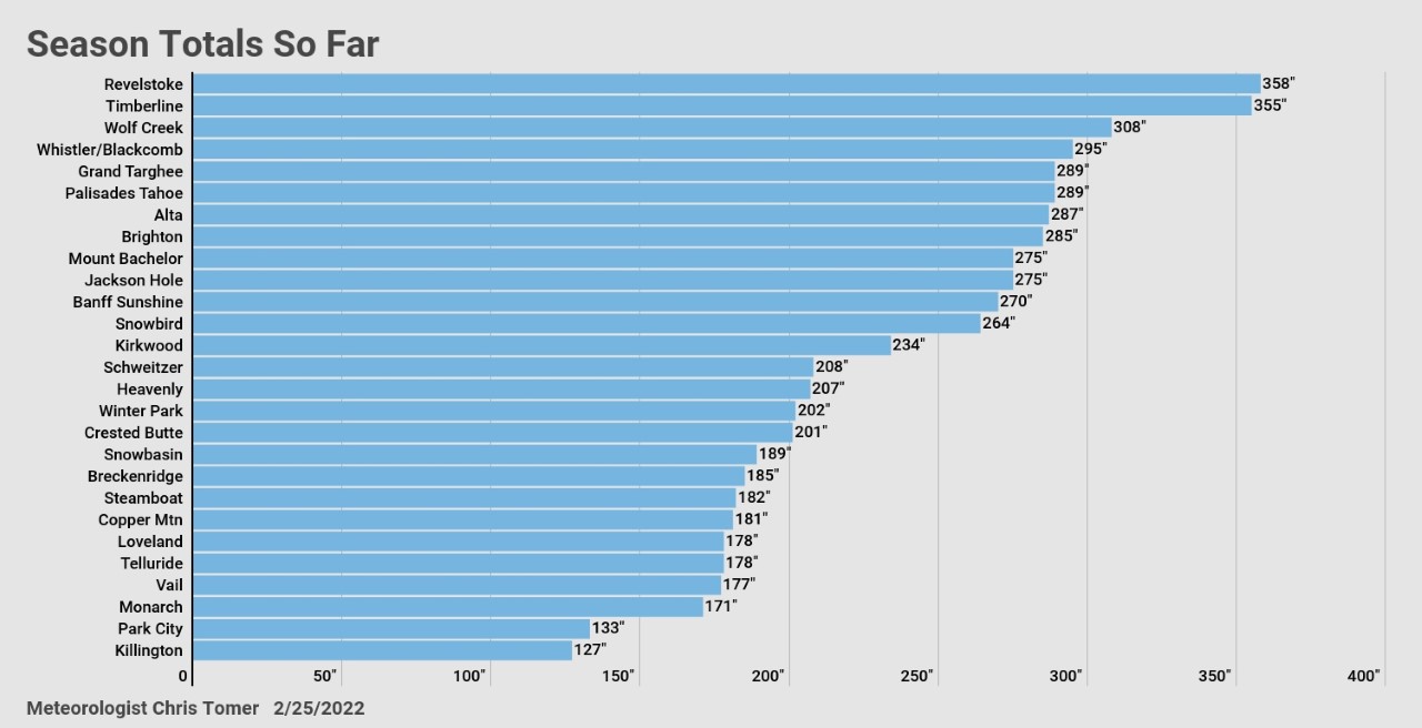
Season Totals so far

Current Setup
Infrared satellite shows the storm track and what’s lined-up for the PNW/B.C. this weekend and early next week.

First 12 Days of March
3/1-3/3: Heaviest precipitation favors the Pacific Northwest, B.C., northern ID, and western MT.
3/3-3/12: Storm track shifts south to include CA, remainder of ID and MT, WY, UT, and CO.
Below, notice the forecast pressure anomalies across the West on 3/12. If this plays out then expect colder temps and snow.

Snow Forecast
2/25-2/28:

3/1-3/6:

Northeast, 2/25-3/6:
90% of this snow falls on 2/25.

For more analysis please watch my forecast video: