Tomer’s Take
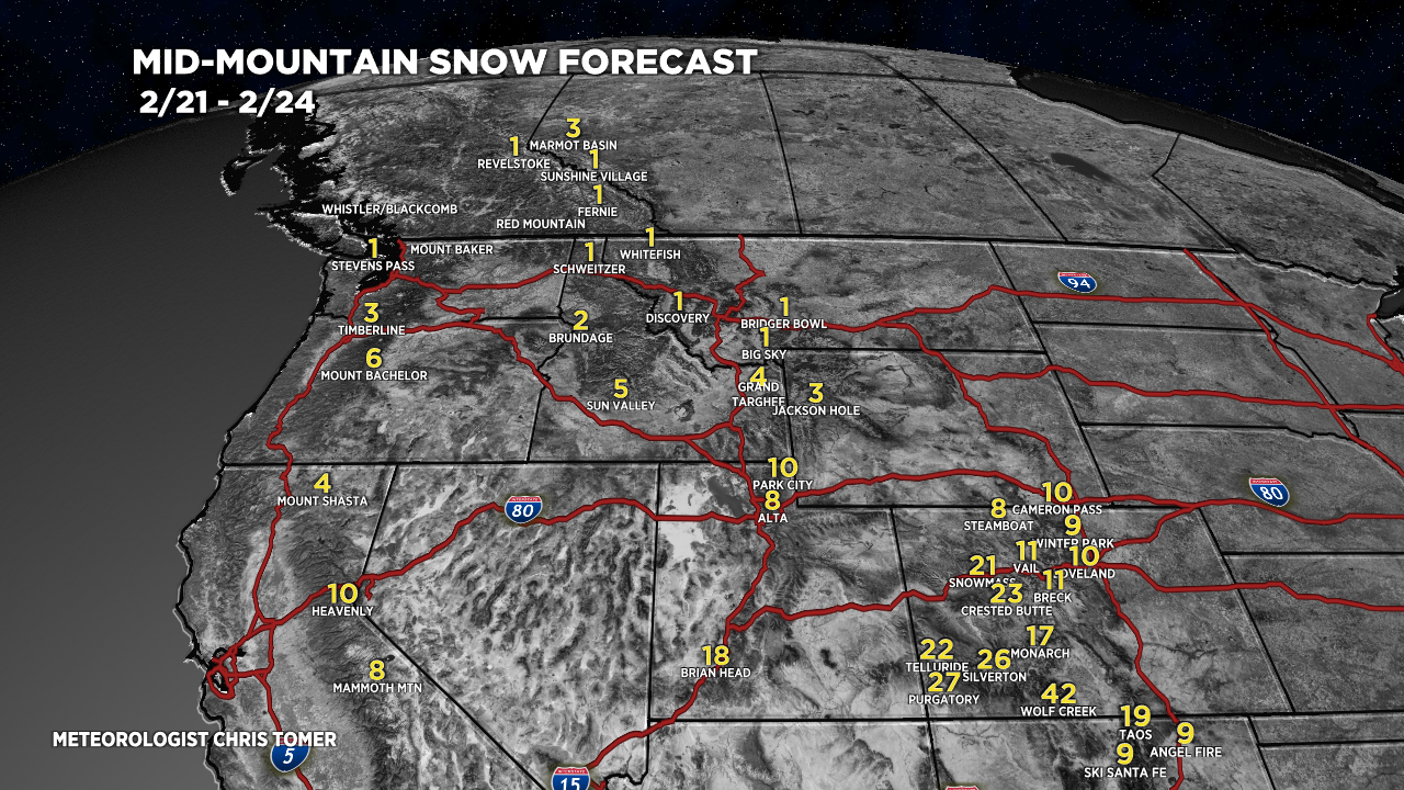
- 12″/24hrs new reported at Jackson Hole and now temps plummet.
- I’m forecasting 6-10″ for the Wasatch through 2/24 and temps plummet.
- Biggest totals of 2-3 feet occur in Western and Southern Colorado by 2/24. This favors Aspen/Snowmass, Crested Butte, Telluride, Purgatory, Silverton Mountain, and Wolf Creek.
- Taos, NM is also in-line for about 2 feet of total accumulation by 2/24.
- Pattern turns drier for the Intermountain West after 2/24 through 3/2. Storm track shifts to the Pacific Northwest and British Columbia.
Infrared satellite shows the storm track and amplified jet stream. The big dip across the West supports the colder air and lower pressures.

Pattern after 2/24
High pressure rebuilds across the Intermountain West after 2/24 through March 3. The storm track shifts to the PNW and B.C.

Snow Forecast
2/21-2/24:

2/25-3/2:

Forecast snow plume for Aspen/Snowmass:

Northeast, 2/21-3/2:
90% of this accumulation occurs on 2/25.

For more analysis please watch my forecast video:
Love your write up!!! All of your readers down here in Northern Arizona would appreciate if you’d crop your map a bit lower and include the Kachina Peaks / Arizona Snowbowl in your forecasts 🙂
Thanks, Charlie! I’m making a list of new items for the future. Chris
I just discovered your forecasts and am so impressed. Super comprehensive and simple to navigate and understand without being bombarded with ads. You are doing god’s work sir. Helping the chasers of the world find our own heaven. Cheers to you fine sir.
Thanks, Rhino! Chris