Tomer’s Take
- Snow is underway across the Tetons. Next stop is the Sierra, Wasatch and Colorado Rockies.
- A strong jet stream will keep mountaintop winds blowing 30-80mph (or higher) 4/11-4/12 in CA, CO, UT, NM. Winds flare again in CO and NM on 4/13-4/14.
- Significant totals likely through 4/15 at mid and higher elevations.
- Another storm system arrives 4/16-4/18.
Snowiest Days:
Tetons: 4/11-4/12, 4/15-4/16
Wasatch: 4/11-4/13, 4/15-4/17
Colorado Zones: 4/12-4/13, 4/17
California Sierra: 4/11, 4/15-4/17
Infrared satellite shows the active storm track and Pacific storm systems.

Wind Gusts
| Gusts in MPH | 4/11 | 4/12 | 4/13 |
| High Sierra | 75 | 45 | 50 |
| Kings Peak, UT | 60 | 40 | 40 |
| Pfeifferhorn, UT | 60 | 60 | 35 |
| Mount Elbert | 50 | 60 | 45 |
| Longs Peak | 45 | 65 | 55 |
| Crestone Peak | 70 | 95 | 60 |
| Wheeler Peak, NM | 60 | 65 | 65 |
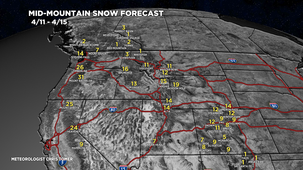
Snow Forecast
4/11-4/15:

4/16-4/20:

Colorado Central and Northern Zones, 4/11-4/15:

Wasatch, 4/11-4/15:

For more analysis please watch my forecast video:
Wow! 95 mph gusts on Crestone Peak possible. That’s no place to be the next few days.
No kidding, powerful jet! Chris
Much needed moisture! We could skip the winds though! Thanks, Chris!
Thanks, Judi! Chris