Tomer’s Take
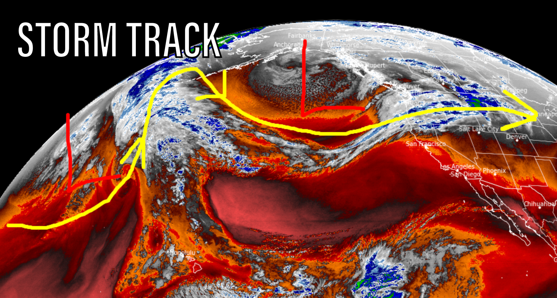
- The jet stream shifts north and blasts the PNW, B.C., and then MT, ID, WY with feet of snow accumulation.
- A large trough of low pressure develops and dip in the jet stream over the North Pacific.
- Starting on 1/4, the jet stream shifts south and begins to target northern UT and the Central and Northern Mountains of CO with big totals 1/5-1/10.
The key feature is the developing trough of low pressure and dip in the storm track in the North Pacific off the PNW coast.

I take a look at the shifting storm track and my snow forecast in two time periods through 1/10 in my forecast video:
Wind
The shifting jet stream will deliver strong wind from the PNW to ID, MT, WY, UT, and CO through 1/8.

Hi Chris,
My wife and I live at 9,500 ft, right by Echo Mountain Ski Resort in CO. We’re avid snow chasers, and your daily blog updates have been a gamechanger in helping us predict where/when to ride. On top of that, you help us forecast how much snowplowing will be required to get out and onto the Mountain, or into the backcountry.
Wanted to thank you for these updates, Sir. Keep up the great work!
Ryan Woodman
Evergreen, CO
Thanks so much, Ryan! Chris