Tomer’s Take: The pattern 2/12-2/15 favors PNW/BC/ID/MT/WY. Then the stormtrack shifts south 2/16-2/22 to favor CA/OR/UT/ID/WY/CO. The overlap between both periods is the Teton Range, WY where I’m forecasting 2-3 feet of grand total accumulation. Overall, the pattern continues trending weaker for most locations. What once looked like a major initial storm system 2/15-2/17 now looks weak/fast/ragged.
In the Northeast, the 2/13 storm system continues shifting south, and that pulls snow accumulation out of VT/NH/ME.
Next storm system arrives late 2/15-2/16.
My afternoon forecast video update:
Current Setup
Water vapor satellite shows a trio of storm systems traversing the North Pacific.
Orange/red = drier air aloft.

Forecast Jet Stream
Forecast Radar & Satellite
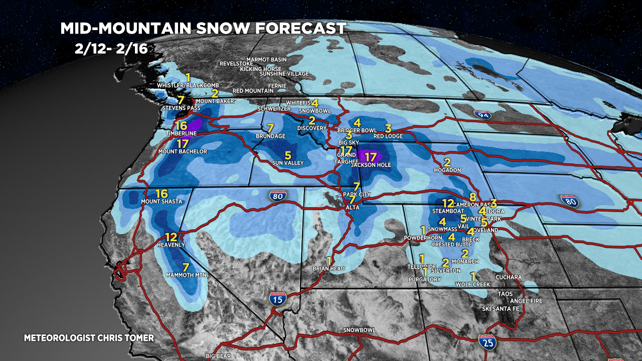
Forecast Totals
Teton snow: 2/13 – AM 2/16, 2/18-2/20.
Wasatch snow: 2/15, 2/18-2/19.
CO Snow C+N Zones: PM 2/15-2/16, 2/18, 2/20.
Sierra snow: PM 2/14 – AM 2/15, 2/17-2/19.


VT/NH/ME snow: Late 2/15-2/16.
