Tomer’s Take
- Reversal of fortune for the West after 2-3 solid weeks of back to back active storm cycles.
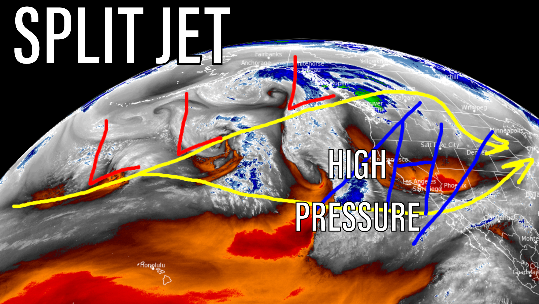
- Large dome of high pressure building across the Intermountain West through 1/15.
- A warmer and drier than normal 6 day period for CO, UT, WY, MT, ID, NM, and CA as a split jet develops over the Pacific.
- The exception is the Pacific Northwest (PNW), British Columbia, and western Alberta where snow is likely with an active storm track.
- A weak to moderate intensity atmospheric river hits the above mentioned areas between 1/11-1/13.
- This will also inject warmer air and push snow levels high.
- Zero snow in my California and Utah forecast through 1/16.
Water vapor satellite reveals the splitting jet stream and building areas of high pressure.

For storm track analysis and snow forecast, please watch my forecast video 1/9/2022:
thanks, I am skiing in Nelson 17-19, hopefully I am not positive with CoVid. but the forecast seems ok for that area. Hope your doing well.
That sounds like fun, Kevin! Chris