Tomer’s Take: A reinforcing cold front drops south through Tetons tonight and into UT/CO by 1/15. Snow starts back up in the Tetons and continues in WY & CO with additional accumulation into 1/15.
The next storm system and WNW Flow arrives 1/17-1/18 with moderate to heavy snow potential in British Columbia/WA/ID/MT/WY/UT/CO.
A new Pacific pattern engages 1/19-1/23 with warmer air and moisture across the West.
My afternoon forecast video update:
Current Setup
Water vapor satellite shows the main Arctic front over CO/UT and the reinforcing 2nd cold front sliding south from MT into WY.
Busy setup in the Pacific with a large trough. A piece of that breaks off and becomes part of the 1/17-1/18 storm system
Orange/red = drier air aloft.

Forecast Jet Stream
Storm system + WNW Flow generates moderate to heavy snow accumulation BC/WA/ID/MT/WY/UT/CO.

New pattern with rich, warm Pacific flow and strong jet. Trough moves through Interior Rockies.

Forecast Radar & Satellite
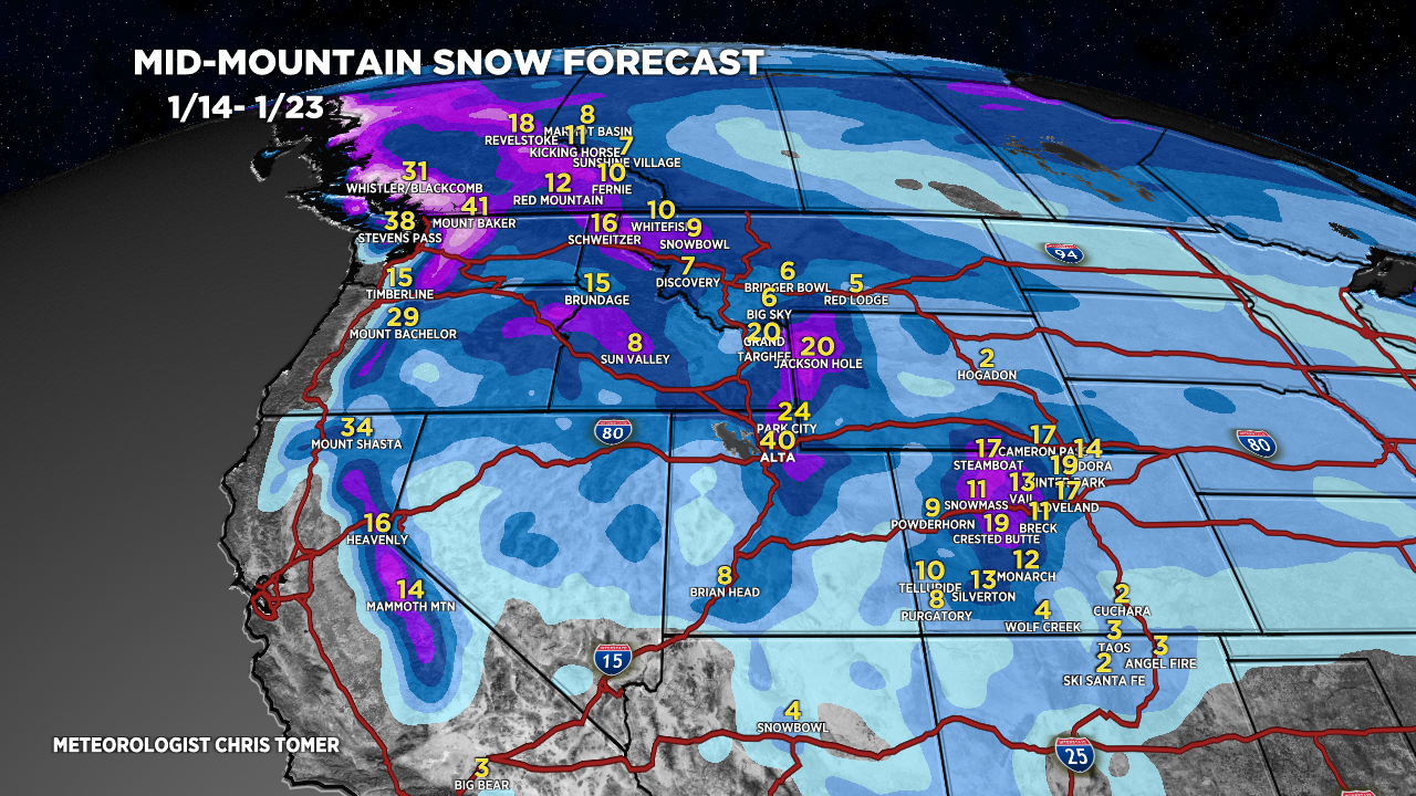
Forecast Totals
Grand totals 1/14-1/23.


Northeast:
Snow 1/14 (light), 1/16 (light), 1/19-1/20 (light).
