Tomer’s Take: It’s a powder Friday and a powder weekend with additional snow accumulation likely in ID/UT/WY/CO. A trough of low pressure approaching the West Coast is sending ripples of energy into the Intermountain West generating snow accumulation.
Snow Timeline
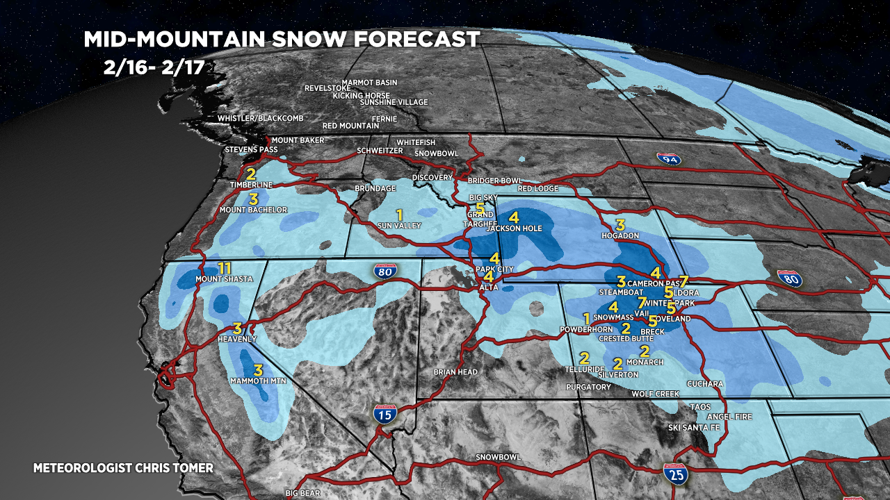
Wasatch 4-6″ Today, 4-6″ 2/18.
Tetons 4-5″ Today, 3-5″ 2/18.
Colorado 2-8″ Today/Tonight, 1-2″ 2/18.
Northeast Light Snow 2/17, 2/18.
My afternoon forecast video update:
Current Setup
Water vapor satellite shows the approaching trough sending ripples of energy into the Intermountain West generating snow accumulation.
Orange/red = drier air aloft.

Forecast Jet Stream
Forecast Radar & Satellite
Forecast Totals


Northeast:
Snow: Light 2/17, 2/18.
