Tomer’s Take
- It’s a powder day in the Wasatch, Tetons, and the Central & Northern Mountains of Colorado.
- Parts of the Snowy Range and Sierra Madre in Wyoming received 30 inches or more.
- There’s one more storm system sliding down the jet stream between Friday-Saturday for ID, MT, WY, UT, and CO.
- Then high pressure builds and the snow machine stops (except in the PNW/B.C.) until potentially 1/14.
Powder day at Loveland Ski Area!

Jackson Hole:

Winter Park:

The northwest-oriented jet stream will keep the snow falling in the Wasatch, Tetons, and Central & Northern Mountains of Colorado. Notice on the infrared satellite the next low pressure hitting the Pacific Northwest. That hits the interior Rockies between Friday-Saturday.

Then high pressure builds into the West. This will curtail snowfall for at least a few days across the Interior West.

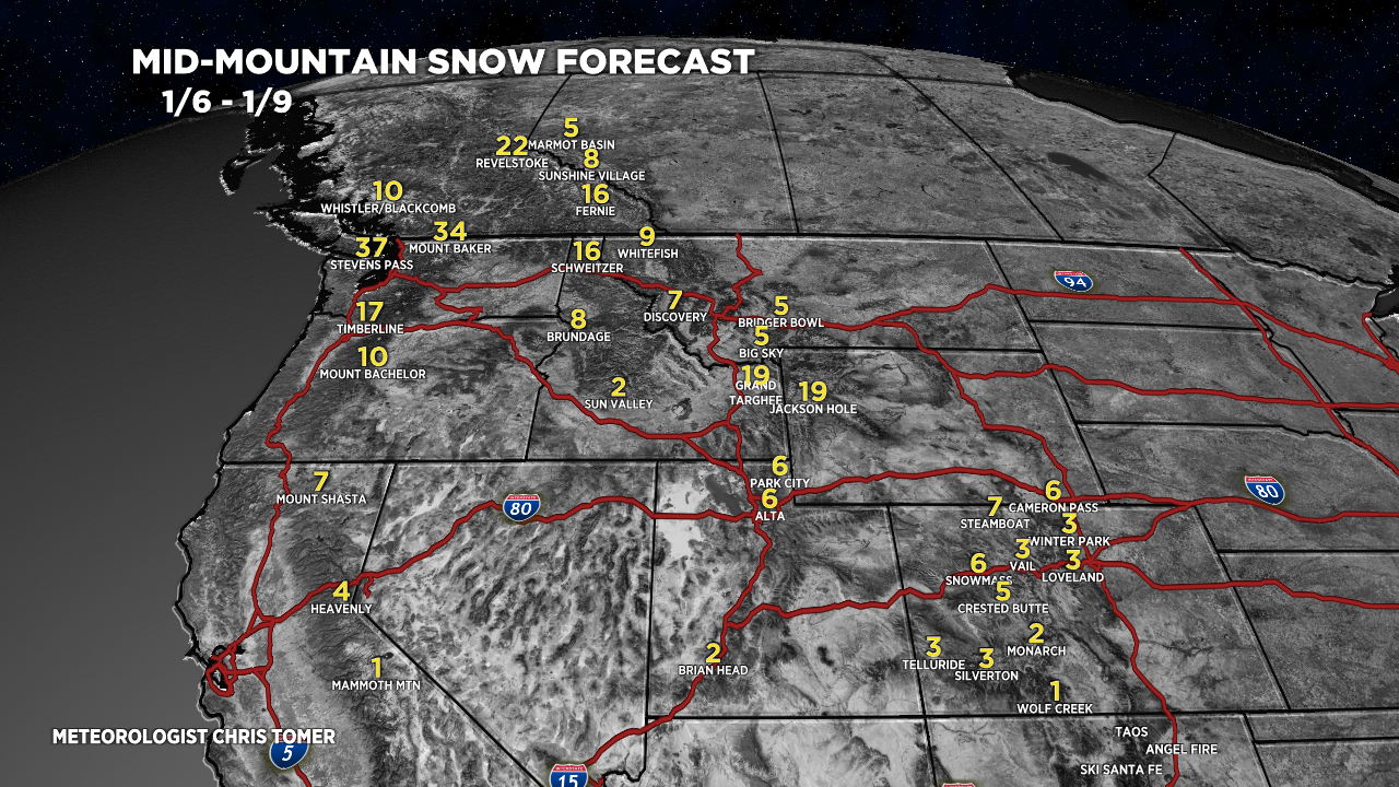
Snow Forecast
Let’s look at my snow forecast in two time-periods.
1/6-1/9:

1/10-1/13:

For more analysis please watch my forecast video: