Tomer’s Take: Snow continues in Colorado today with a storm system then it moves into VT/NH/ME with moderate to heavy snow accumulation late 3/9-3/10. The Western pattern shifts north 3/9-3/11 to favor the PNW/BC/Northern Tier. It shifts back south into UT/WY/CO 3/11-3/14 with moderate to heavy snow accumulation.
Timing
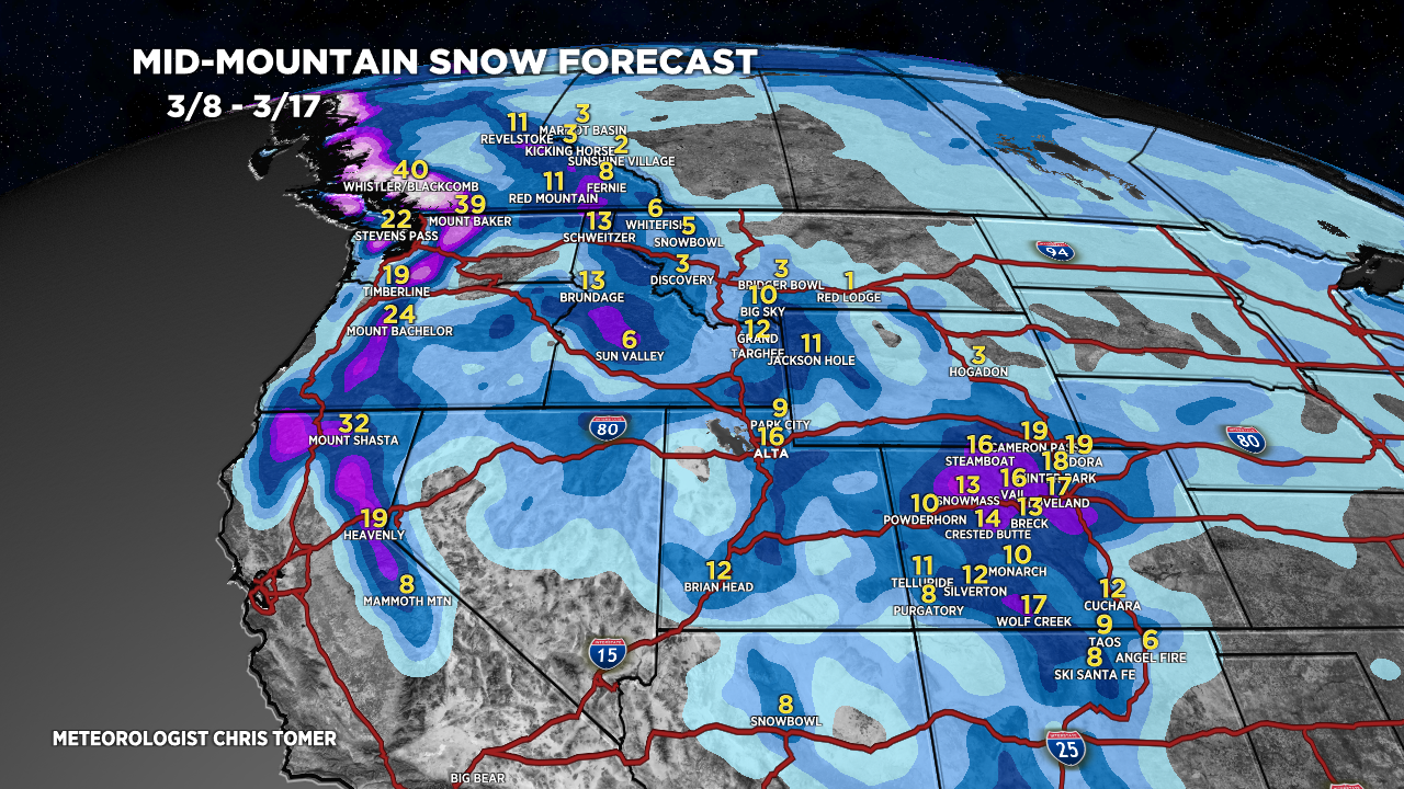
Colorado: Light to moderate snow 3/8, L late 3/11, M/H 3/13-3/14.
Wasatch: Light snow PM 3/11, H 3/12-3/13.
Tetons: Moderate to heavy snow 3/11-3/13.
Revelstoke: Moderate to heavy late 3/9-3/13.
Northeast: Moderate to heavy snow late 3/9-3/10.
My afternoon forecast update video:
Current Setup
Water vapor satellite shows the CO storm system departing with a trajectory for the Northeast.
The Northern Jet becomes dominate 3/9-3/11 with a couple different storm systems lined-up that will eventually drop south into UT/WY/CO 3/11-3/14.
Orange/red = drier air aloft.

Forecast Radar & Satellite
Forecast Totals
Grand totals by late 3/17.


