Tomer’s Take: Merging jet streams deliver a “Robust Quick Strike” of heavy snow accumulation (& strong wind 50-70mph) to ID/WY/UT/CO 2/26-2/27. This storm system has trended faster/weaker. Storm #2 is bigger and hits PNW/CA/ID/WY/UT/MT/CO with feet of accumulation 2/29-3/4.
My afternoon forecast video update:
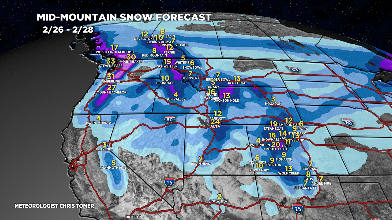
Forecast Timeline
Two Storm Systems Through 3/4.
Storm #1 “Robust Quick Strike”.
Wasatch: 1-2FT PM 2/26 – AM 2/27.
Tetons: 1-2FT 2/26-2/27.
Colorado: 10-20 inches PM 2/26 – 2/27.
Idaho: 4-15 inches PM 2/25-2/26.
Storm #2 Is Major 2/29-3/4, Feet of Accumulation.
Northeast gets rain or rain/snow 2/28.
Forecast Jet Stream
Forecast Radar & Satellite
Forecast Totals


I know you don’t usually cover this area on your updates but I’m heading to Alaska (Alyeska) during the 2/29-3/4 time period. Will they be getting hit with this storm system too? Thank you!
Hi Tiffan! Alyeska gets light to moderate snow accumulation today/tomorrow but then it’s dry for about 5-7 days. Chris