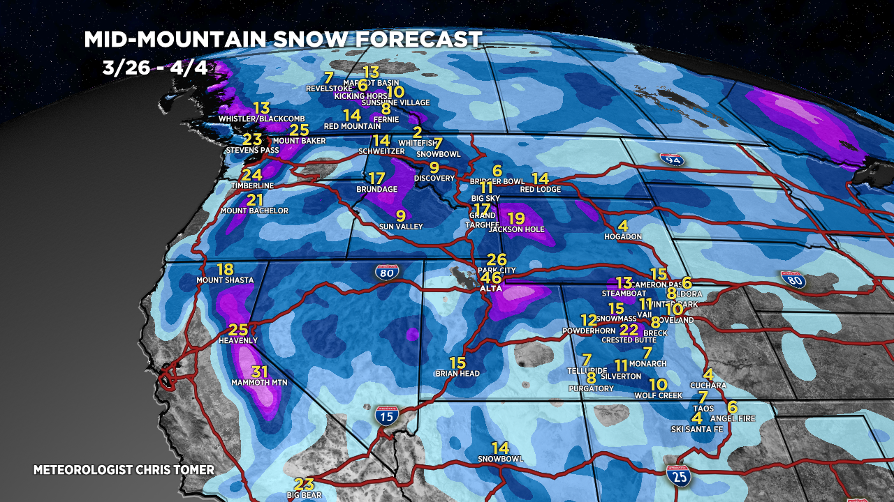
Tomer’s Take: Light to moderate snow accumulation hits UT/WY/CO through early 3/27. Heavier accumulation arrives 3/28-3/31 with two additional storm systems. A pattern change occurs 4/3-4/5 with energy dropping south out of Canada/BC/PNW.
Timing
*Updated 4:30pm 3/26/2024.
CO/UT Light/Moderate snow accumulation tonight – AM 3/27.
Sierra: H PM 3/27 – AM 3/28, H PM 3/29-3/31.
Tetons: M/H 3/28, H PM 3/31.
Wasatch: L/M PM 3/26 – AM 3/27, H 3/28, H PM 3/29-4/1.
Colorado: L/M PM 3/26 – AM 3/27, H 3/29-4/1.
Northeast: L 3/27, R/S 4/2-4/3.
My afternoon forecast video update:
Forecast Radar & Satellite
Forecast Totals
Grand totals by late 4/4.


Snowing pretty good right now @9600’ central Summit County (base of Buffalo). Around 2” since 11:00am.
Thanks, Bruce! Should continue into early 3/27. Chris