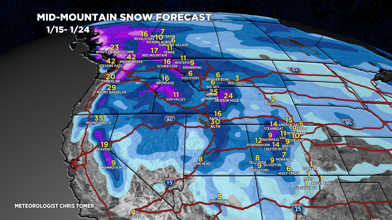
Tomer’s Take: Grand totals hit 86 inches with this storm cycle (Over 6″SWE, Alta, UT, Buffalo Pass, CO). What’s next? A storm system and efficient WNW Flow delivers moderate to heavy snow accumulation to BC/WA/ID/MT/WY/UT/CO 1/17-1/18.
Beyond this, a warmer Pacific flow pattern takes over 1/19-1/24.
My afternoon forecast video:
Forecast Jet Stream
Storm system + WNW Flow.

Forecast Radar & Satellite
Forecast Totals
Grand Totals 1/15-1/24.


Warmer Pacific flow pattern with strong subtropical jet and waves of moisture with higher snow levels.

