Tomer’s Take: Four different areas of low pressure are lined up for the West Coast and primarily California through 1/7. It’s a mild flow with heavy snow accumulation only at higher elevations. Very little moisture survives the trip into UT/ID/MT/WY/CO through 1/5. The pattern starts to shift after 1/5 with colder air rotating south from Canada into the Lower 48 and a storm system.
My afternoon forecast video:
Current Setup
Water vapor satellite shows an active Pacific flow with strong areas of low pressure lined-up. Main impact is to West Coast.

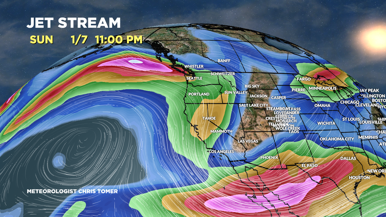
Forecast Jet Stream
Valid 1/6. A deep trough and colder air dives south into the Lower 48. This could be the pattern changer.

Valid 1/7. Same trough moves east with jet support.

Forecast Radar & Satellite
Forecast Totals
CA higher elevations get bigger totals. Mount Shasta could see 10-20 inches afternoon 12/29 through morning 12/30 above 10,000ft.

UT Snow: 1/4 (light), 1/6-1/7.
WY Snow: 1/1 (light), 1/6-1/7.
CO Snow: 12/31 (light), 1/4 (light), 1/7.

VT/NH/ME: 12/30 (light), 1/4 (light to moderate).

Happy holidays Chris! Thanks for adding kicking horse to the map!
Thanks, Brett! Happy New Year to you too. Chris