Tomer’s Take
- Snowstorm for parts of the Northeast on 3/12. Rain/snow line cuts through southern NH, southern ME. Best snow accumulation occurs in VT, northern NH, and northern ME.
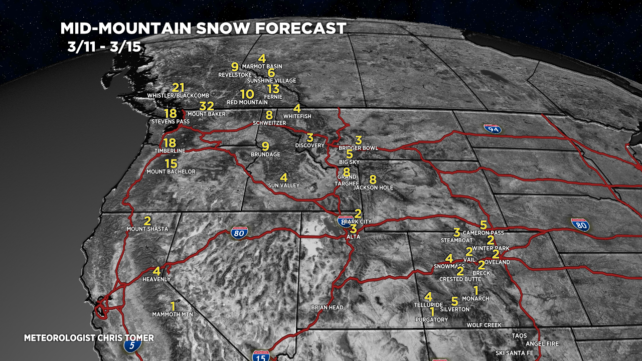
- Western storm track shifts 3/13-3/15 into the Pacific Northwest, British Columbia, Idaho, Montana, and Wyoming.
- Then it gradually shifts south 3/15-3/18.
- A “sleeper snow” hits Utah, Montana, and Colorado between 3/13-3/14 with 2-8″.
Skies have cleared in Colorado and mountain air temperatures are running -10 to -25F. Look at this spectacular sunrise view of 14,115′ Pikes Peak. Current summit air temp is -14F.

Water vapor satellite shows the large trough developing in the north Pacific taking aim at the PNW.

Northeast 3/12
Notice the rain/snow line slicing through southern NH and southern ME on 3/12. This will cut down on total accumulations.

Snow Forecast
Northeast, 3/11-3/15:

3/11-3/15:

3/16-3/20:

For more analysis please watch my forecast video: