Tomer’s Take: The final storm system in this cycle is moving into the PNW/BC. Overrunning light to moderate snow continues across the Tetons through this afternoon then the pattern dries out for a few days. This storm brushes UT on 11/7 with light accumulation, and hits CO on 11/8-11/9 with light to moderate accumulation. All forecast snow totals are trending down in WY, UT, CO.
After brief high pressure ridging on 11/12, the pattern shifts and a large trough of low pressure slides into the West Coast. The Subtropical Jet becomes involved. See forecast jet below. This pattern initially favors the PNW/BC for heavy snow then it shifts south and hits CA.
My forecast video:
Current Setup
Water vapor satellite shows the remaining area of low pressure moving into the PNW/BC.

Forecast Jet Stream
Valid 11/8. Dip in the jet with storm system moving through the Intermountain West.

Valid 11/15. New pattern. Large trough of low pressure sliding south from PNW/BC into CA with heavy snow totals and colder air. Subtropical jet also starts interacting.

Valid 11/15 middle of the atmosphere. Notice the low pressure anomalies off the West Coast. This would deliver snow and colder air.

Forecast Radar & Satellite
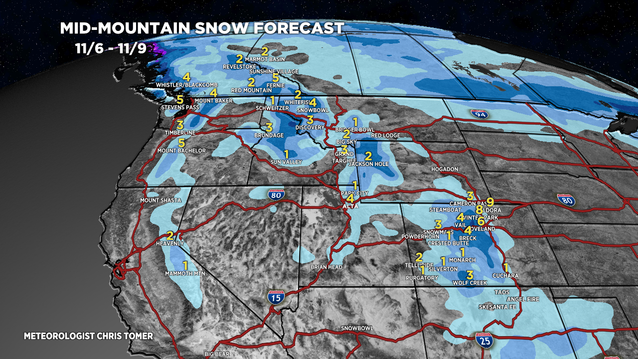
Forecast Snowfall
*Updated 2pm 11/6.
Valid 11/6-11/9 mid-mountain.

*Updated 2pm 11/6.
Valid 11/10-11/14 mid-mountain. Heavy snow possible around Tahoe 11/14-11/15. Heavy snow through BC 11/10-11/14.
