Tomer’s Take
- 2-3 additional storm systems lined-up through 1/2/2022 for the West.
- Merger possible between two storm systems near the 4-Corners 12/31-1/1. This would generate a larger, stronger storm system for UT, CO, NM, WY.
- My forecast is based on at least a partial merger.
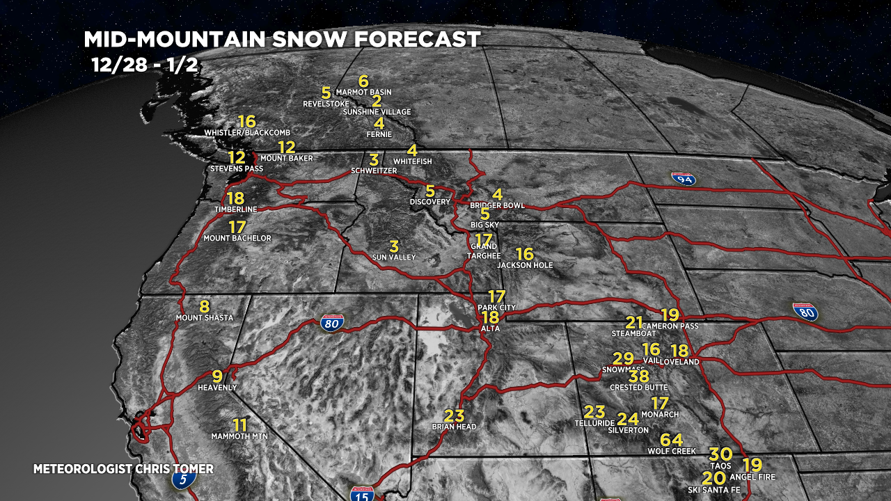
- Crested Butte just hit 60″ in the last 5 days. I’m forecasting another 38″ by 1/2/2022. That equates to a storm cycle grand total of 98″. That’s in-line with the Bury the Butte storm cycle of 2017.
- Palisades Tahoe is reporting 113″ of snow in the last 7 days. That equates to about 16 inches every single day.
The current setup on infrared satellite shows the active storm track reaching back into the Pacific basin. I marked the two key storm systems involved in the potential merger.

Merger
A Pacific low pressure and cold front could merge with a low pressure moving in the from the desert southwest. There’s plenty of jet stream support to coddle this merger.

If this occurs then expect a surge in wind across the West as the jet stream translates through 12/30-12/31.

Snow Forecast

Drilling down, here’s my Steamboat snow plume forecast:

For more analysis please watch my forecast video:
Chris,
You said that you were surprised to see that Brighton had received more snow than Alta. This is not unprecedented when storm tracks produce a southwesterly flow. Big Cottonwood Canyon is favored in a southwesterly flow. Little Cottonwood is favored in a northwesterly flow, with lake effect enhancement.
Thanks, Mark. Yes an interesting turn of events with this SW flow dominant storm cycle. Chris