Tomer’s Take
- The first large storm system in the series is on track with big totals across the West.
- Cycle duration lasts through 1/1/2022.
- Widespread feet of grand total accumulation in the Wasatch, Tetons, and Western Slope ski areas of Colorado.
- Major avalanche cycle in the backcountry.
- Overall biggest grand totals through 1/1/2022 at Wolf Creek, Silverton, Telluride, Purgatory, Alta, Snowbird, Jackson Hole, Grand Targhee, and Crested Butte.
20″ in 24 hours at Crested Butte, CO:

A huge trough of low pressure is the key. You can see it on the water vapor satellite below. It’s taking up most of the eastern Pacific basin located off the West Coast. Pressures are running at least 3 standard deviations below the 30-year average.

The pattern stays amplified with major jet stream support through 1/1/2022.

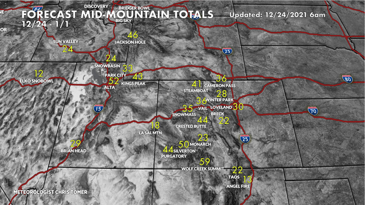
Snow Forecast
How much additional snow will fall through 1/1/2022 across the Intermountain West?
Grand totals through 1/1/2022:

Drilling down, here’s my snow plume forecast for Alta, UT:

And, Crested Butte, CO:

For more analysis please watch my forecast video:
Telluride is not on the map. Is that because we have an unknown total amount?
No! I rotate ski towns off/on. It looks like 30-40″ mid-mountain through 1/1. Best, Chris
Hi Chris, since Telluride only received 3” or 4” with the storm ending on Christmas Day, do you foresee significantly lower totals through January 1?
Will Westcliffe/Wet Mountain Valley see any snow from this storm?
Not your business!
Thanks for your informative forecasts. Will you no longer do forecasts for the West Coast? Bachelor is my local mountain, so I would appreciate getting your insights for there.