Tomer’s Take
- Data is pointing towards a major storm cycle setting up from 12/23-1/1 across the West.
- 3-5 large storm systems possible.
- All storm systems will rotate through a major trough of low pressure and prolonged dip in the jet stream.
- Atmospheric pressures could run 3+ standard deviations below the 30-year average into 1/1/2022.
- Feet of accumulation and high avalanche cycle.
Let’s first look at the setup on water vapor satellite. The red colors represent drier air aloft; whites and blues are moisture aloft. Notice the big dip in the storm track developing off the West Coast. This is the key to the next 10 days.

The jet stream takes a prolonged dip across the West. This guides the snow into the Interior Rockies through 1/1/2022.
Forecast jet stream on 12/25:

Forecast jet stream on 1/1/2022:

Snow Forecast
Let’s look at my snow totals in two time periods.
12/21-12/23:

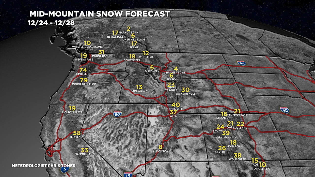
12/24-12/28:

Drilling down, here’s my snow plume forecast for Snowbird, UT:

This scenario would be similar for Alta, Jackson Hole, Grand Targhee, Silverton, and Wolf Creek.
For more analysis please watch my forecast video:
Awesome stuff Chris! Can you include a Plume for Steamboat in one of your future posts? Headed there on the 29th.
Happy Holidays!
Thanks, Joe, will do! Best, Chris
Greetings from Aspen! The snow train is full steam ahead! You must be in heaven forecasting all those flakes! Your forecasting efforts are much appreciated.
Thanks, Randall, yes this could be a major storm cycle. Fascinating to watch it play out. Hope you’re well! Chris