Tomer’s Take
- 3-5 additional storm systems lined-up through 1/2/2022 for the West.
- Major additional snow totals measured in feet in CA, UT, WY, CO.
- 50-110mph wind gusts 12/26 across UT, CO, WY.
- Uncertainty New Year’s Eve into New Year’s Day with potential major storm system merger over UT, WY, CO.
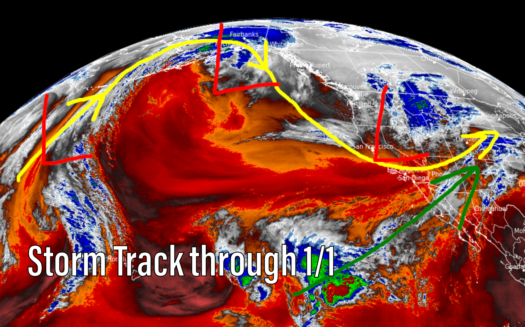
Here’s the water vapor satellite image with storm track. Storm systems are lined-up through 1/1/2022.

Strong wind likely in UT, WY, CO on 12/26. Will see a spike 12/30 and again 1/1-1/2 depending on storm system(s) merger potential.

For more analysis, snow forecast, and snow plumes please watch my forecast video:
Thanks Chris! I am really enjoying this new blog. Crossing my fingers for the merger!!
Thanks so much, Amanda! It’s going to be very interesting to see how it plays out this week. Chris
You’re the best!!!
What phrase… super, magnificent idea
Thanks, Anthony! Chris