Tomer’s Take
- A fast moving cold front delivers light snow accumulation to MT, UT, WY, UT, CO, NM between 1/24-1/25.
- Cold air and 2-3 Alberta Clippers this week for the Northeast. A larger storm system possible this weekend in VT, NH, ME.
- Pattern could flip in February with snow returning to the West.
Infrared satellite and storm track shows the Western high pressure ridge.

February Pattern Change?
Confidence is growing for a pattern change starting February 1. Lower pressures could replace the big Western high pressure ridge. Snow could return to California for the first time in a month.

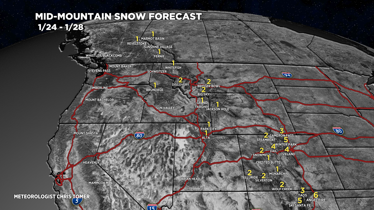
Snow Forecast
1/24-1/28:

1/29-2/2:

For more analysis please watch my forecast video:
Thanks!
I’m in Omaha going to Denver.
Should I leave this afternoon or tomorrow morning for Denver?
I think this afternoon.
Thanks!
Jim
Hi Jim, it’s snowing right now in Denver through Noon then tapering-off! Chris
We’ve already had two clippers hit us in the Midwest now we’re bracing for the bitter cold
Thanks, Richard! Chris