Tomer’s Take
- A cold front sneaks through the eastern periphery of this Western high pressure on Friday 1/14.
- This fast-moving cold front delivers light snow accumulation to Montana, Wyoming, and Colorado on Friday 1/14. Then it’s back to dry weather for a week.
- The most active weather occurs in British Columbia and at times WA.
- When will a larger pattern change occur for the Intermountain West? Data is mixed and confidence is low. There are signs of a stronger cold front around the 22nd or later, but even this could be optimistic.
The infrared satellite shows the storm track. The jet stream remains most active in British Columbia and at times WA.

Longer Range
Looking down the road, a stronger cold front might brush the Intermountain West around 1/22 or later.

Snow Forecast
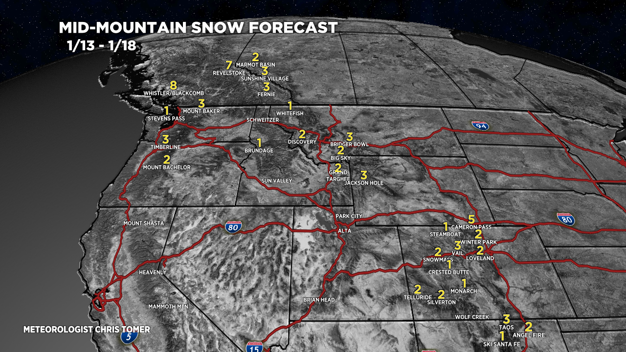
A minor, fast-moving cold front hits MT, WY, and CO on 1/14 then it turns dry until 1/22-ish.
1/13-1/18:

1/19-1/22:
The snow you see in MT, WY, and CO occurs on/around 1/22.

For more analysis please watch my forecast video:
How am I able too send you videos
Hi Jerry, you can email me: chrisdtomer@gmail.com. Chris