Tomer’s Take
- A series of minor, fast-moving storm systems race through the Intermountain West through 4/9.
- A larger storm system hits the Pacific Northwest 4/3-4/5 with significant high elevation snow accumulation.
- April storm systems are normally warmer and snow levels run higher.
Infrared satellite shows the storm track and storm systems lined-up.

April
April is the snowiest month of the year at numerous mountain sites. Take a look at this graphic from Climatologist Brian Brettschneider, PhD:

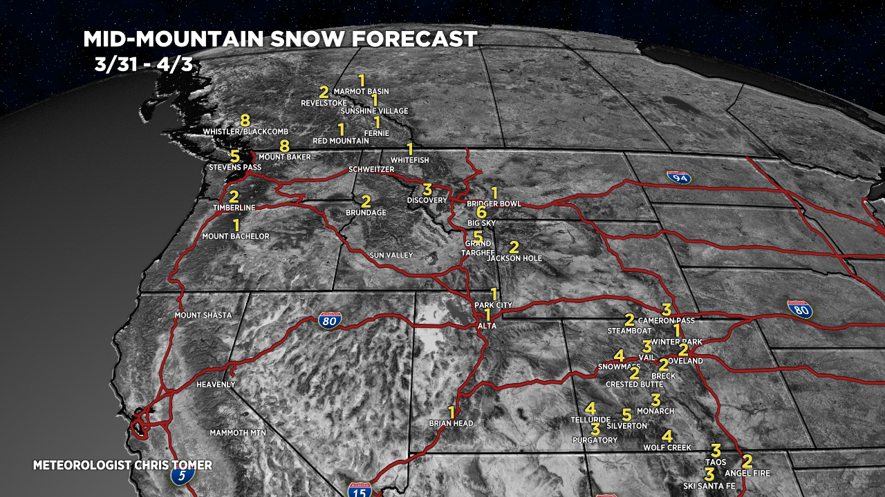
Snow Forecast
3/31-4/3:

4/4-4/9:

Northeast, 3/31-4/9:

For more analysis please watch my forecast video: