Tomer’s Take
- At one point, the current Western storm system looked like it might develop into a major snowstorm in Colorado. Now it’s minor.
- High pressure rebuilds 3/22-3/27.
- A new Western storm system hits California on 3/27 then moves east into UT, ID, WY, MT, CO, NM on 3/28-3/29.
- That’s followed by an active storm track in the Pacific Northwest, British Columbia, northern ID, and northwest MT 3/29-3/31.
Current Situation
8″/24 hours reported at Alta, UT.
7″/24 hours reported at Jackson Hole, WY.
Infrared satellite shows the storm track and current Western storm system.

3/28-3/29
A new storm system hits California and the West Coast on/around 3/28. Below, notice the forecast pressure anomalies.

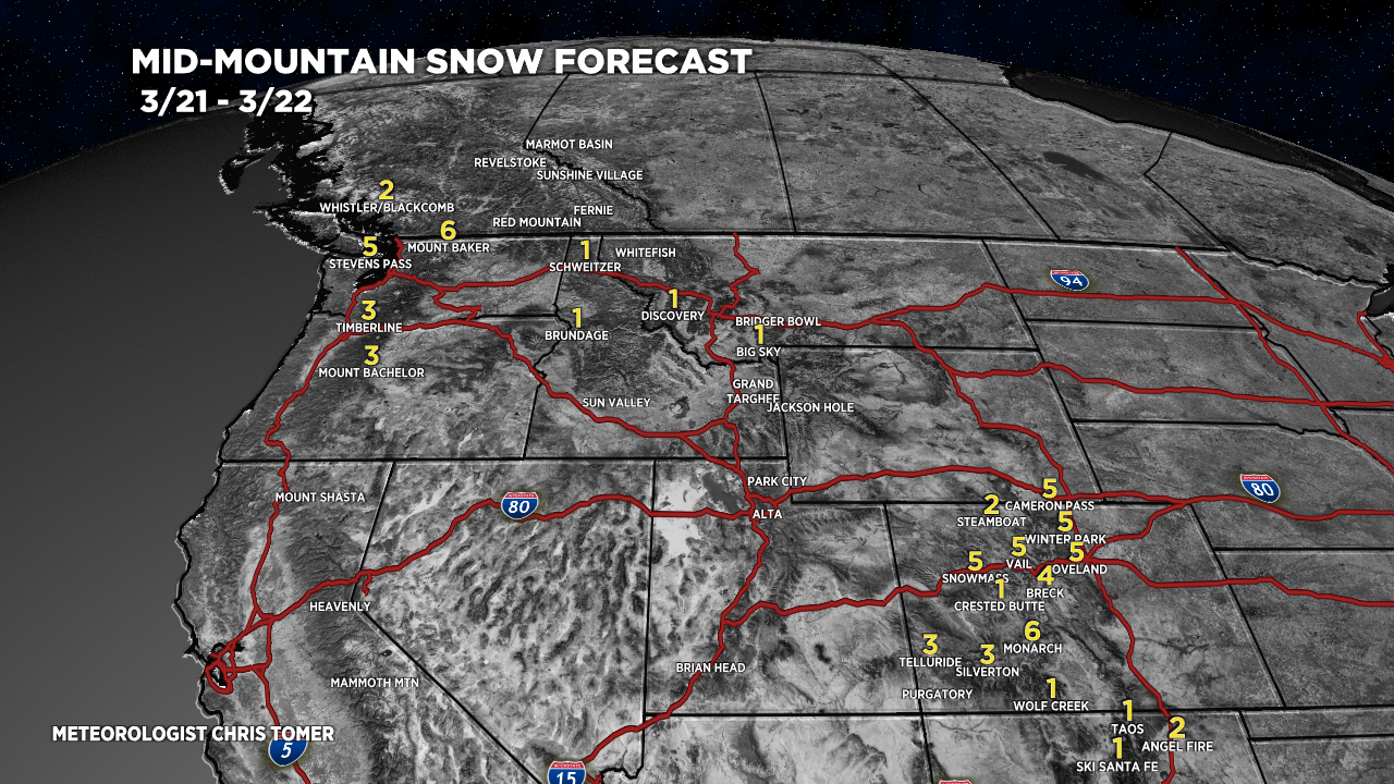
Snow Forecast
3/21-3/22:

3/23-3/27:

3/28-3/30:

Northeast, 3/21-3/30:
