Tomer’s Take
- Active storm track for the Intermountain West through 4/10 with numerous minor, fast-moving storm systems. Snow levels could run high at times. Significant grand total high elevation snow possible.
- I don’t see much for California.
- Beyond 4/10, a large dip in the jet stream might overtake the West including California. This could mean colder and stormier than normal. One last surge of “Winter”.
- Colorado normally reaches maximum snowpack the first week of April then the big Spring Melt starts. The forecast snow and cold for the second week of April might delay this melting.
Infrared satellite shows the current storm track and storm systems lined-up.

Beyond 4/10
It’s possible a big dip in the jet stream and lower pressures overtake the West. Below, notice the forecast pressure anomalies valid 4/11-4/12, Euro interpretation. This could mean one “last gasp of Winter”.

Snow Forecast
4/1-4/3:

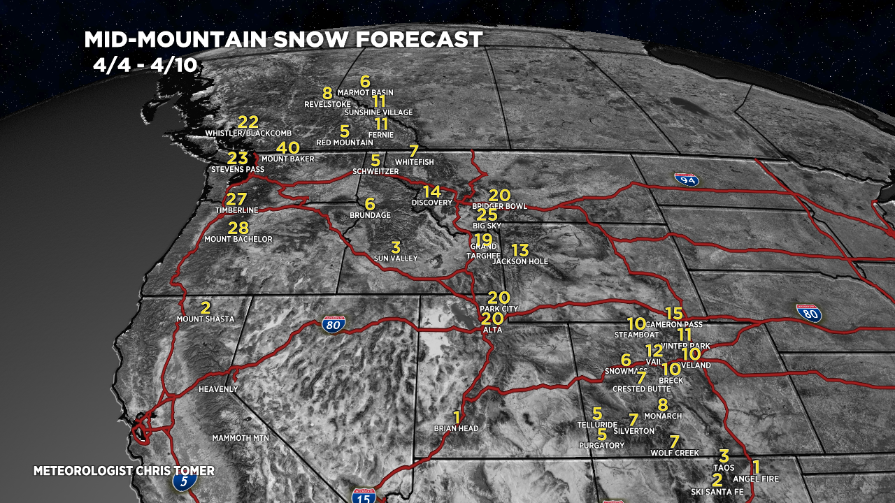
4/4-4/10:

Northeast, 4/1-4/10:

For more analysis please watch my forecast video:
“Oh my god Becky, look at the size of that Low”! Fingers crossed for some late April moisture.
Thanks, Erin! Chris
Big sky was 4+ yesterday. Great job on the predictions last week! That’s why your the MVM!
Thanks, Randall! Hope you’ve had a great season. Chris