Tomer’s Take
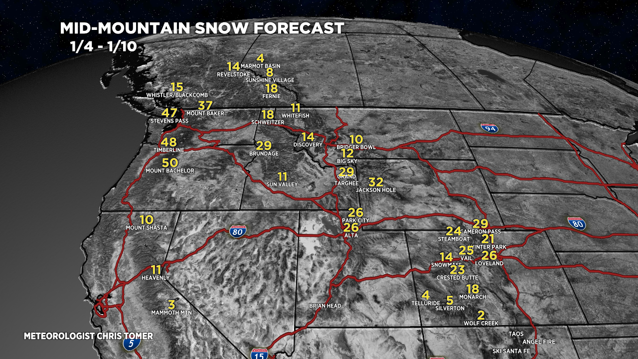
- The first storm cycle of 2022 is taking shape in the Gulf of Alaska/B.C. Coast. This trough of low pressure becomes the dominant player 1/2-1/10 for the Pacific Northwest, Banff, WY, ID, MT, UT, and CO.
- 9-day storm cycle grand totals in Crested Butte, CO reached 99″. Another inch or so is certainly possible pushing the total to 100″. Snow-water-equivalent on Schofield Pass has reached 14.2″. That’s huge and surpasses all other years on record as far as I can tell.
- Wolf Creek reached a 9-day storm cycle grand total of 118″. Another inch or so also possible there.
- Silverton Mountain is reporting a 9-day storm cycle grand total of 100″.
Snow returns to UT, WY, and CO around 1/4. A few different storm systems are lined-up. For more analysis please watch my forecast video.
You are awesome Chris! Thank you for all the work you do. I’m a ski bum and I read and watch your updates everyday. You rock!
Thanks so much, Travis! Chris